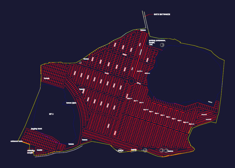
CLASsIFICATION of TERRITORY
Drawing labels, details, and other text information extracted from the CAD file (Translated from Spanish):
Mexico state, santa maria jajalpa, gral. mariano matamoros, Ignacio Allende, Benito Juarez, av. of the pines, Vicente Guerrero, galeana, Vicente Guerrero, independence, leon guzman, Saragossa, independence, road santiaguito, Benito Juarez, san francisco tepexoxuca, san pedro zictepec, atlatlahuca, edge twist, san francisco tetetla, san francisco putla, san miguel balderas, santa cruz pueblo new, san pedro tlanixco, santiaguito cuaxustenco, jockey, basic symbology:, state limit, municipal boundary, urban trace, regional road, primary road, Powerline, body of water, River, runoff, Level curve, archaeological zone limit, pyramids, scale:, date:, orientation:, location:, name of the map:, key:, February, classification of territory, government of the state of mexico secretary of urban development housing, h. valley tenango town hall, urban development plan, valley tenango, Mexico state, thematic symbology, Urban area, buildable area, non-buildable area, tourist area, aurb, year, year, aurb, aurb, year, considerations for areas with differing limits, limit of the traverse of nahuatlaca state park matlazinca, zone whose use is subject to the conservation program management of the state park published in the official newspaper gaceta de gobierno de estadode mexico no. May of the, zpcm, the present municipal plan of urban development does not prejudge the territorial limits of the only establishes the officially recognized by the government of the state of mexico organic article in the areas with differing will only be able to exercise administrative acts for the territorial ordering of the human settlements of the urban development of the centers of those authorities that are recognized administrative jurisdiction in the territory until the competent authority issues a ruling. the present does not generate rights for the territories in question the territorial dispute. note: the areas that can be left after the respective distributors are carried out in this plane will be applicable the regulations that correspond to the properties with which it borders.