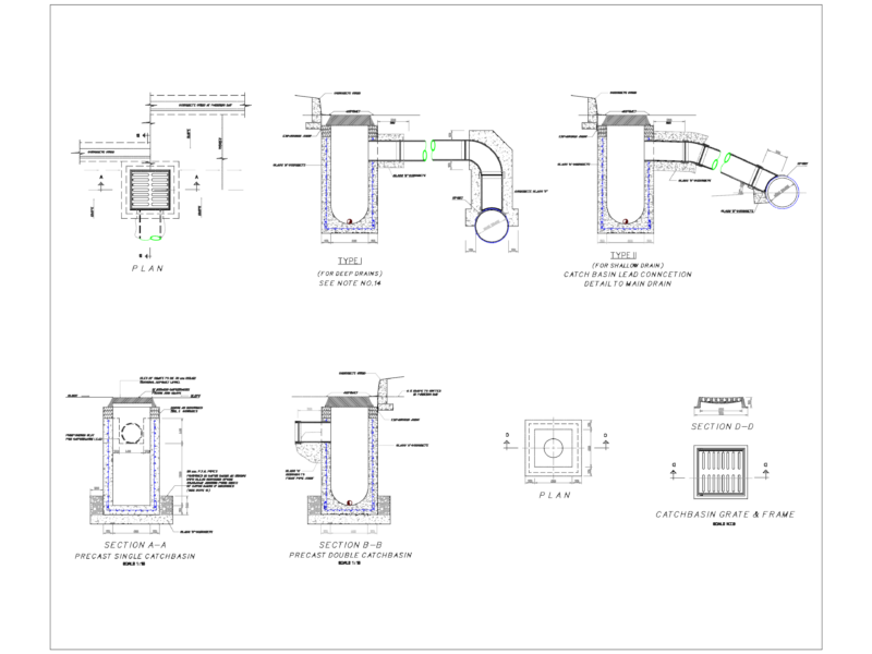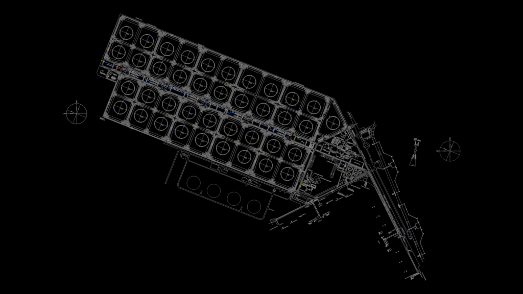
Maasvlakte Oil Terminal Facility Layout
This comprehensive site plan depicts the Maasvlakte Oil Terminal facility layout including storage tank arrangements, pipeline networks, and marine infrastructure. The drawing shows detailed positioning of:
Storage Infrastructure:
– Multiple tank farms containing approximately 39 storage tanks (TK1-TK39) arranged in organized groups
– Additional specialized tanks including TK401-TK404
Marine Facilities:
– 4 jetties with associated mooring and breasting dolphins
– Detailed labeling of marine components (M1-M6, B1-B4, etc.)
– Oil boom deployment locations
Pipeline Systems:
– Main pipeway corridors connecting tank farms to marine terminals
– Pipeline specifications including sizes (24″, 30″, 36″, 42″)
– Various valve arrangements (VRC/VBC designations) and pressure relief systems
Site Features:
– Internal road network with labeled streets (1st-11th Streets, 1st-5th Avenues)
– Support facilities including control building, workshops, and substations
– Security infrastructure with gates and site boundary fence
– Topographical features with elevation markers in meters (ranging from approximately 3.3m to 9.8m)
The drawing uses both plant north and true north (RD) coordinate system references, with specific coordinates provided at key points for precise positioning and alignment with Dutch national grid.