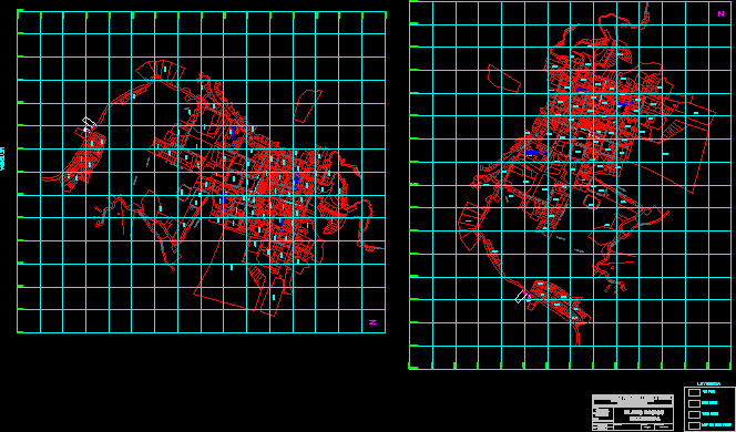
In details the Cadastre Plano City San Miguel also the closest zoning.
Drawing labels, details, and other text information extracted from the CAD file (Translated from Galician):
n.m., location plane, scale:, i.e.p.nº manuael sanchez díaz, circulation, approx, sector, camino calquis, pro novro pedro, road calquis, santa rosa road, sector, bishopric of cajamarca, r. bolognesi, park, r. g., broken, r. n., broken chulis, Broken the secret, san pedro stadium, public bathroom, r. n., sector, patio, future house, parochial, garden, patio, garden, church, atrium, limit not determined, hamlet road, aceqiua, broken, flat road, broken chulis, limit not determined, gaps of oxidation, limit not determined, Limit not determined, Broken the secret, prolg the Andes, flat road, prolg jose olaya, municipal complex, prolg the Andes, livestock plaza, hamlet road, prolg j. galvez, livestock plaza, experimental center, sector, one floor, two floors, three floors, more than three floors, legend, provincial municipality of san miguel, urban cadastre office, year update, region:, district district:, city:, san miguel de pallaques, san miguel, Cajamarca, cadastral basic plane, date:, June of, Ing. l vega j., cad:, approved:, scale:, reference: