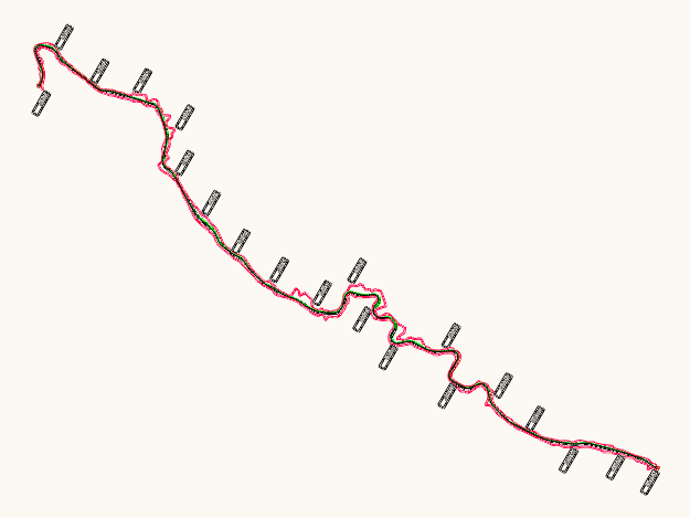
This drawing is for a road alignment plan showing the center line & station markers ranging from 2+900 to 12+450. We’ve included the right-of-way boundaries and basic site survey data. Everything is in metric. This could be useful in civil infrastructure planning or road design projects.
Road Alignment Center Line Plan With Stationing Marks