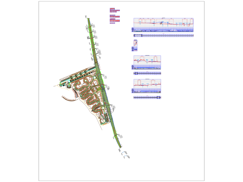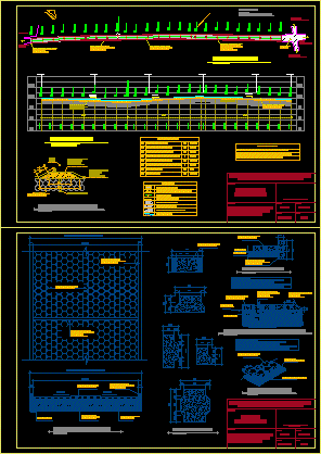
Contains plant; profile details paved the way.
Drawing labels, details, and other text information extracted from the CAD file (Translated from Spanish):
north, pavement section, concrete curb, paving road, symbology, indicates station, confinement key, existing paving, dirt road, projecting tile in project, select compacted base, sand base, natural terrain, base select, mine sand, variable, confinement key:, confinement key and finishing tile, isometric of adoquin, no scale, details of adoquin, plant and cross section, cemetery, towards road, main, towards center, village ranch tile, towards, momostenango, paving, existing, preliminary works, laying of paving, finishing tile, final cleaning, project summary, road profile, road plant, concrete smelting, land, natural, towards places, coordinates utm: , detail vent pluvial water, material base, select compacted, vo.bo. ing. civil, project :, contains :, drawing :, divin r., municipal planning direction, municipality of san francisco el alto, totonicapán., plant-profile, rural road improvement ,, chirij cemetery, site, scale :, date :, leaf: indicated, cobbled, village tiled ranch., details, mine sand bed