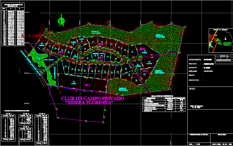
Sierra Floresta Urbanization DWG Block for AutoCAD
Design private country in slope at Santa Cruz de la Sierra- Bolivia
Drawing labels, details, and other text information extracted from the CAD file (Translated from Spanish):
tree, total, sup, lot no., do not., total, sup, lot no., do not., total, sup, lot no., do not., road santa cruz, nelfy medina b., roger s. Mrs., sup., sup af., sup, edverto mojica sandoval, fair brown, silvia josefina eid de nielsen, leonardo yelma c., area, green area, sabino yelma, ecological Reserve, green area, equipment, area of streets, of street axles, coordinate sheets, pto, dry seal, santa, esc., cadastral nomenclature, plan no., cadastral nomenclature of origin, zone, Location, owner, object, the lathe, Santa Cruz, andres ibañez, province, municipality, Department:, date of measurement, location sketch, ptos, perimeters, coordinate box, do not., lot no., sup, total, batch surface sheets, surface, useful area, green area, ecological protection area, total area of the, description, surface balance, percentage, property, area equipment, tree, tree, ecological Reserve, lagoon, ecological Reserve, way of entering ml of asphalt, private country club, sold, query, sold
Raw text data extracted from CAD file:
| Language | Spanish |
| Drawing Type | Block |
| Category | City Plans |
| Additional Screenshots |
 |
| File Type | dwg |
| Materials | |
| Measurement Units | |
| Footprint Area | |
| Building Features | Car Parking Lot |
| Tags | autocad, beabsicht, block, bolivia, borough level, COUNTRY, cruz, de, Design, DWG, la, political map, politische landkarte, private, proposed urban, road design, santa, sierra, slope, stadtplanung, straßenplanung, urban design, urban plan, urbanization, zoning |
