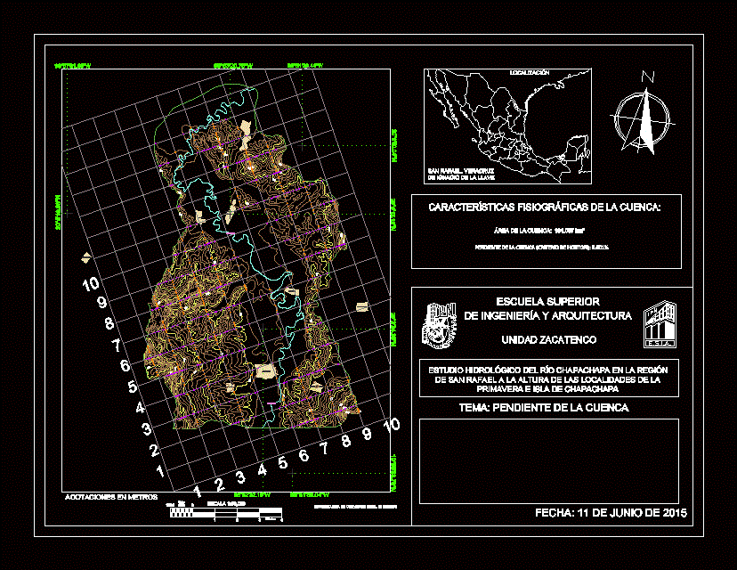
Plan showing Horton criteria to determine the slope of the river basin Chapachapa in Veracruz
Drawing labels, details, and other text information extracted from the CAD file (Translated from Spanish):
palpoala ixcán, arroyo hondo, coapeche, spring, adalberto tejeda, island of chapachapa, la martinica, esia, zacatenco unit, theme: slope of the basin, meters, kilometers, dimensions in meters, physiographic characteristics of the basin :, upper school , engineering and architecture, hydrological study of the Chapachapa river in the region, San Rafael at the height of the towns of the spring, and island of Chapachapa, San Rafael, Vera Cruz, Ignacio de la Llave, location, Chapachapa River