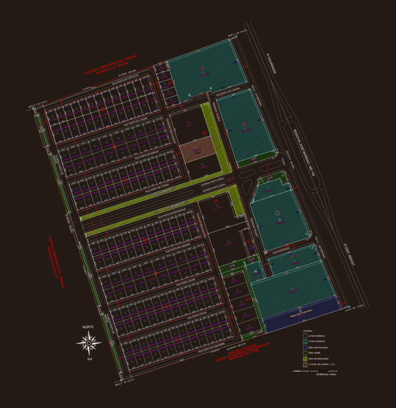
Topographic Map of the city of St. Hilarion – Peru
Drawing labels, details, and other text information extracted from the CAD file (Translated from Spanish):
jr., Garden of, jr., fernando belaunde terry, beautiful view, windmill, prolg. ucayali, prolg. jose galvez, windmill, tap, jr., prolg. cashew, prolg. huallaga, j.c.m., c.n. j.c.m., prolg. Amazon, jr., lagoon, windmill, c.e.p., lagoon, stadium, lagoon, tarapoto, jr., jr., market, evangelical, church, c. Health, church, catholic, jr., suspension bridge, right edge, left edge, parade ground, children, municipal, paleness, jr. san hilarion, holy field nº, cemetery nº, sports field, description, city, road fernando belaunde terry, symbol, sisa river, contour lines, June, topographic map, scale:, Map:, map of hazards of the city of san hilarion, study:, date:, flat:, new, sustainable cities, indeci