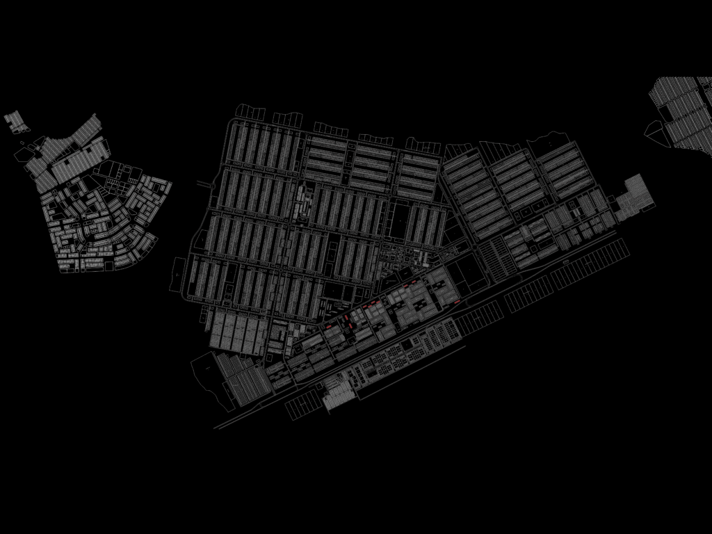
Urban layout showing detailed lot divisions, street networks, & specialized sector classifications. incl. parceling for residential, industrial, commercial, & administrative zones with specific labels for public facilities like schools, hospitals, churches, & sports centers. Extensive lot numbering, block IDs, & street naming included for addressing throughout the grid. Mentions specific areas like Setor de Expansão Econômica, Setor Hoteleiro, Vila DNOCS, etc. Comprehensive plan with over 50k entities covering a wide metropolitan area. Labels and text are in Portuguese (lotes, conjuntos, endereçamneto).
Urban Master Plan and Regional City Layout with Lot Details