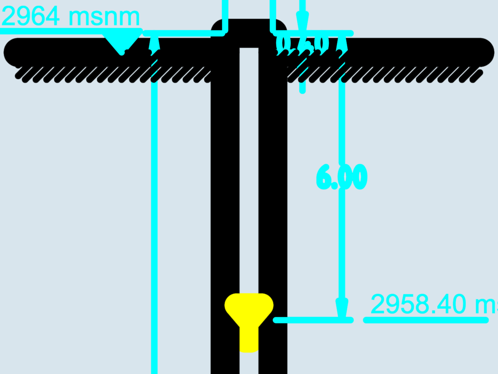
Sectional detail of a water well or excavation shaft showing specific elevation markers. Ground level is indicated at 2964 msnm, while the internal component or water level is set 6 meters below at 2958.40 msnm. We’ve used standard hatch patterns to denote the earth surface around the opening. Layers are separated for water, dimensions, and the main drawing elements. This is a clean, simple schematic that works for basic civil engineering or hydrogeology site plans. The file uses metric units and features clear callouts for vertical distances.
Water Well Section Detail with Elevation Marks