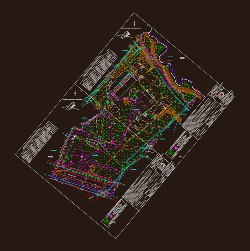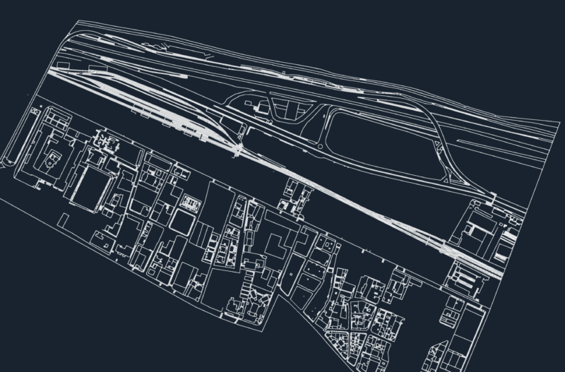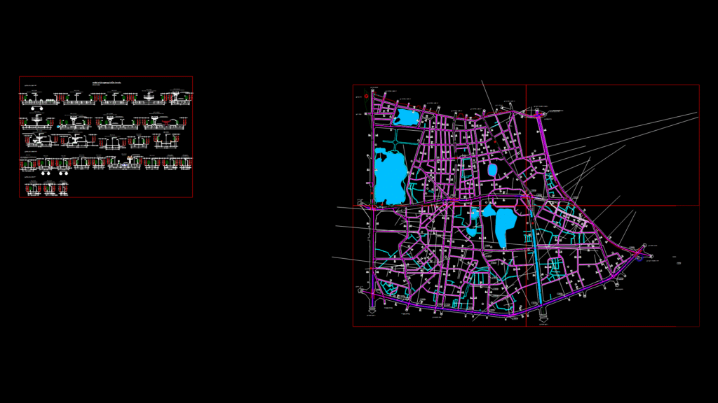
Comprehensive urban planning map for H1-4 district in Hai Ba Trung district, Hanoi, Vietnam at 1:2000 scale. The drawing (QH-06B) illustrates red line boundaries, construction boundaries, and technical infrastructure protection corridors. The plan includes multiple transportation routes with detailed cross-sections showing dimensions for Ring Road 1 (19-26m width), Ring Road 2, and local streets (ranging from 1.5-22m width). Key elements include:
Transportation Network
– Metropolitan rail system with multiple lines (#1, #2, #3) and stations
– Urban arterial roads with coordinate reference points
– Neighborhood access roads with varying widths
– Tran Hung Dao tunnel indicated for future development
Technical Details
– Road curvature radii ranging from R125m to R3000m
– Turning points with precise coordinate references
– Cross-section details for 18 different street types
– Protection boundaries for infrastructure corridors
– Water bodies integrated within the urban fabric
The plan covers neighborhoods including Nguyen Du, Le Dai Hanh, Bui Thi Xuan, Ngo Thi Nham, Pho Hue, Dong Nhan, Pham Dinh Ho, Dong Mac, Bach Dang, and Bach Mai. This is an official planning document prepared by the Hanoi Urban Planning Institute for approval by Hanoi People’s Committee.