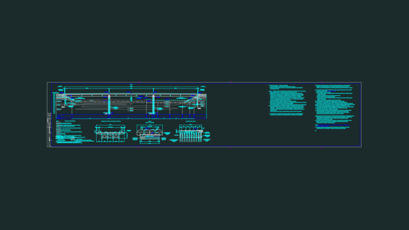
Comprehensive highway engineering drawing showing both plan and profile views of a major roadway project spanning 36.4km. The drawing contains detailed vertical alignment reports for sections KM 14+000 to 22+000 and KM 25+000 to 34+000, plus horizontal alignment data covering the entire corridor (KM 0+000 to 36+400).
The profile sections feature elevation datums ranging from 138m to 198m, with each kilometer segment clearly demarcated. Key infrastructure elements include:
Design Components:
– Road centerlines with geometric data
– Drainage facilities including ditches and culverts
– Box culvert structures
– Earthworks (cut/fill areas)
– Right-of-way boundaries
– Paved shoulders and footpaths
The drawing integrates multiple cross-referenced elements (XREFs) for base topography, proposed improvements, and technical cross-sections. Layer organization indicates compliance with standard highway engineering practices, with separate categories for structural elements, drainage, geometric controls, and earthworks.