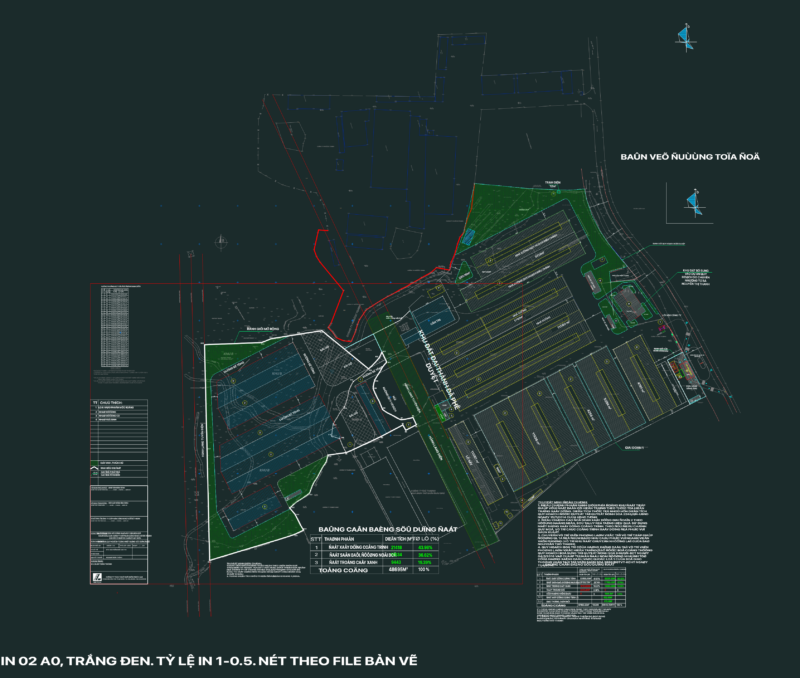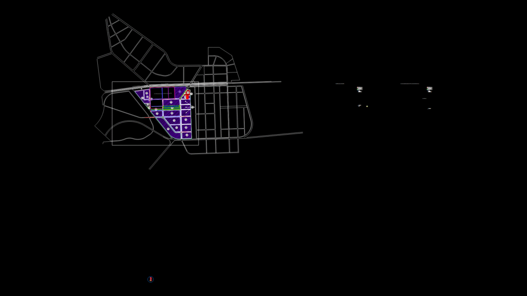
A detailed land use zoning plan for the Nam Dinh Vu DEEP C2A Industrial Park development. The drawing illustrates the master planning of various land use categories with clear color-coded zones including industrial land (predominantly shown in purple), technical infrastructure, specialized green areas, drainage channels, public green spaces, and water reservoirs. The plan features lot CN7.2 and identifies a 110/22kV power station.
Key Components:
– Planning boundary delineation with building lines
– Industrial zones for factories and warehousing
– Commercial and service areas
– Technical infrastructure corridors
– Specialized green buffer zones
– Drainage channels and water management features
– Road network including the Tan Vu-Lach Huyen Road
The drawing includes a comprehensive legend detailing lot names, areas, maximum building heights, maximum building densities, and maximum land-use ratios for development control. The plan is designed in accordance with Vietnamese industrial zoning regulations with bilingual Vietnamese-English annotations.