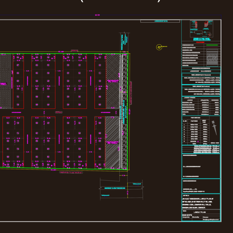
Coastal Magdalena sea coast
Drawing labels, details, and other text information extracted from the CAD file (Translated from Spanish):
ga, topographic, magdalena, lima, coastal beach, municipality of magdalena del mar, location :, drawing :, plane:, topography :, scale :, date :, province :, department :, district :, professional, geotop, highway beach , municipal deposit, district limit, marbella down, wall, marbella, set, marbella down, buildings, mailboxes and levels, green areas, main curve, secondary curve, telephone poles, light poles and at, walls of protection, milestones, path, way, legend, faucet, ladder, topographic, puericultorio, fence, pacific ocean, owner:, fence, housing of third parties, wall of protection, wall of protection, grotto, av. spine, ca. d. ferre, wall, concrete, sports complex chamochumbi, ps. future, ps. progress, castagnola malecon, district boundary, bm ign virg, bm ign virgin, index of planes, sports slabs, or, no, mn, lm, kl, jk, ij, hi, gh, fg, ef, de, cd, bc , ab, distance, side, vertex, technical data table-coord. utm, polygonal base, guardrail protection, barrier protection, fence