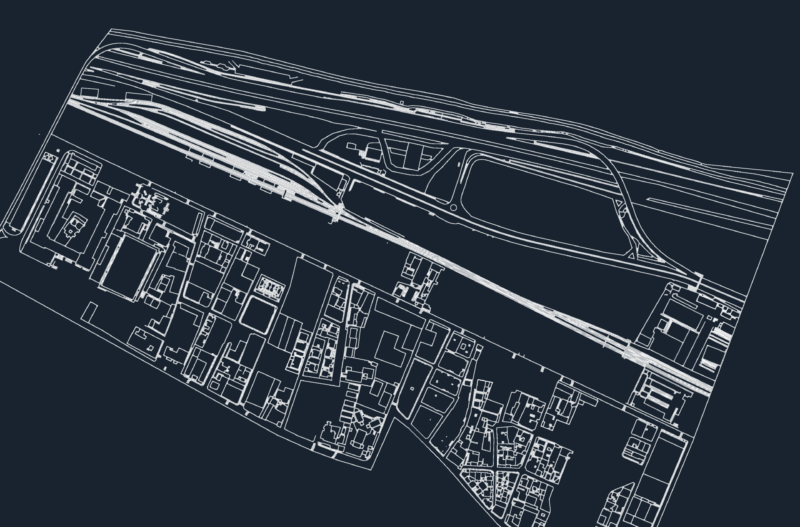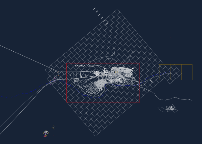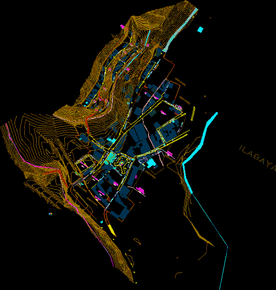
Topography, roads and plots
Drawing labels, details, and other text information extracted from the CAD file (Translated from Spanish):
new street, owned by third parties, farmland, owned by third parties, farmland, passage, owned by third parties, farmland, green area, communal, services, other purposes, new street, education, Health, irrigation ditch, tacna street, incline passage, calle arica, street luna pizarro, owned by third parties, farmland, communal, services, street luna pizarro, Street Bolivar, other purposes, green area, communal, services, communal, services, street luna pizarro, passage, communal, Street, moon slate, services, irrigation ditch, owned by third parties, farmland, owned by third parties, farmland, Park, education, irrigation ditch, passage, Street, Moon, pizarro, square, sports area, green area, passage, passage, Commerce, Street, owned by third parties, farmland, of the state, ground eriazos, of the state, ground eriazos, services, communal, passage, of the state, ground eriazos, area, green, passage, area, green, area, green, passage, area, green, farmland, owned by third parties, passage, Park, area, green, area, green, passage, of the state, ground eriazos, square, area, green, passage, area, green, chejaya road, farmland, owned by third parties, communal, services, street level, tacna street, communal, services, new street, tacna street, cont, cont, pzt, cont, cont, cont, ilabaya