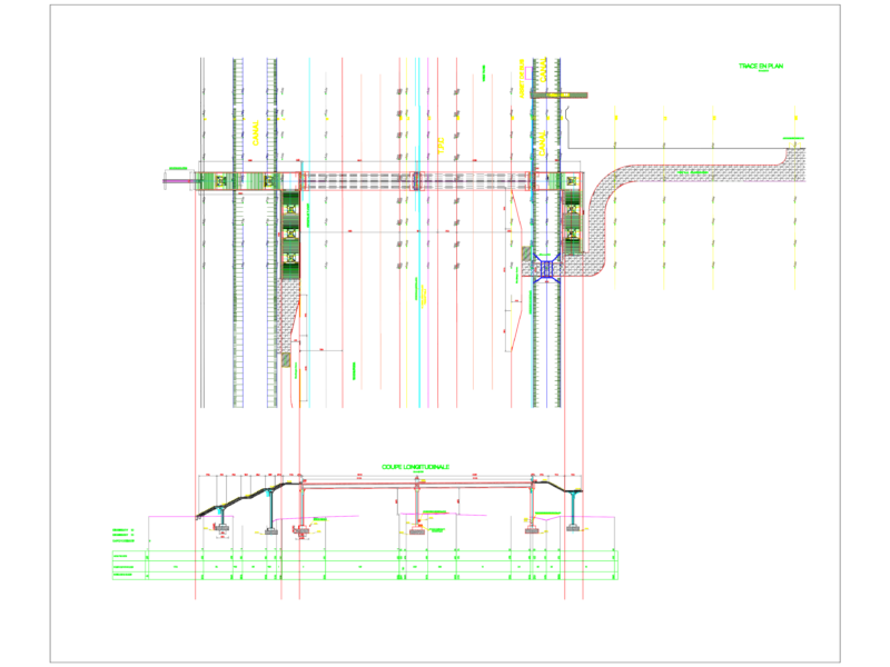
Map of paving a stretch of road
Drawing labels, details, and other text information extracted from the CAD file (Translated from Spanish):
mexico, street axis, variable, sidewalk, street, drawing:, sketch of location, notes :, conform, modify, date, project :, approved:, supervise:, vo. bo. :, sheet __ of __, location: guadalupe plan, municipality of a. del monte., date:, title: paving of main street, graphic scale, c e n t i m e t r o s, sketches of location, approved:, supervised:, no. classification, plan: only, north, reviewed:, h. municipal council constl., atlamajalcingo del monte, warrior, public works management, tlapa, a metlatonoc, the rosary, juanacatlan, fco. imadero, igualita, white stone, benito juarez, santa cruz, guadalupe plan, huehuetepec, juquila, chinameca, alvaro obregon, alacatlazala, atlamajalcingo del monte, tepecocatlan, san isidro, my homeland is first, zilacayotitlan, a marquelia, tlapa highway marquelia, to malinaltepec, cruise atlamajalcingo del monte, cuautipan, tlaxco, simbología :, g. c. m., construction of the physical polygon, side, distance, course, azimuth, vert., ang.int., adjoining, cross section, garrison detail, project pavement, masonry wall, garrison, npt, table of dimensions of wall