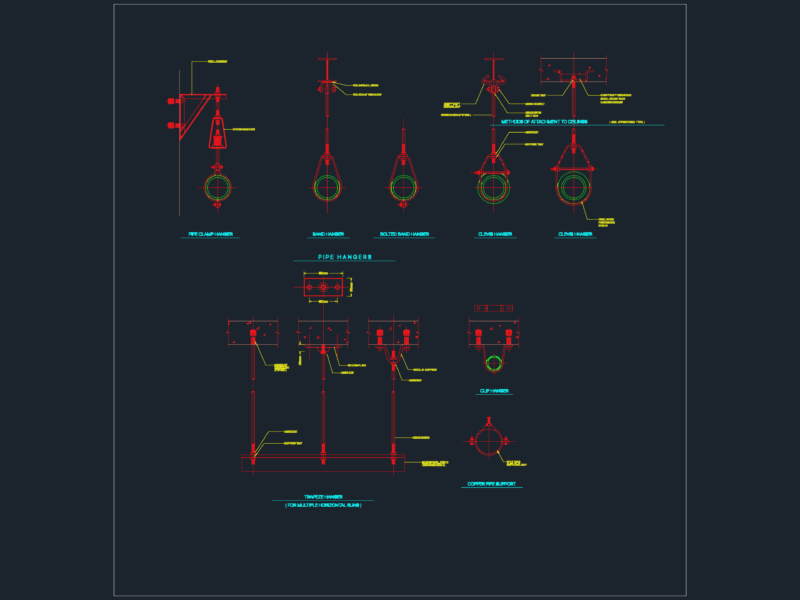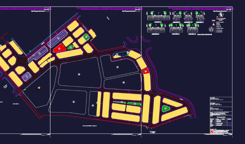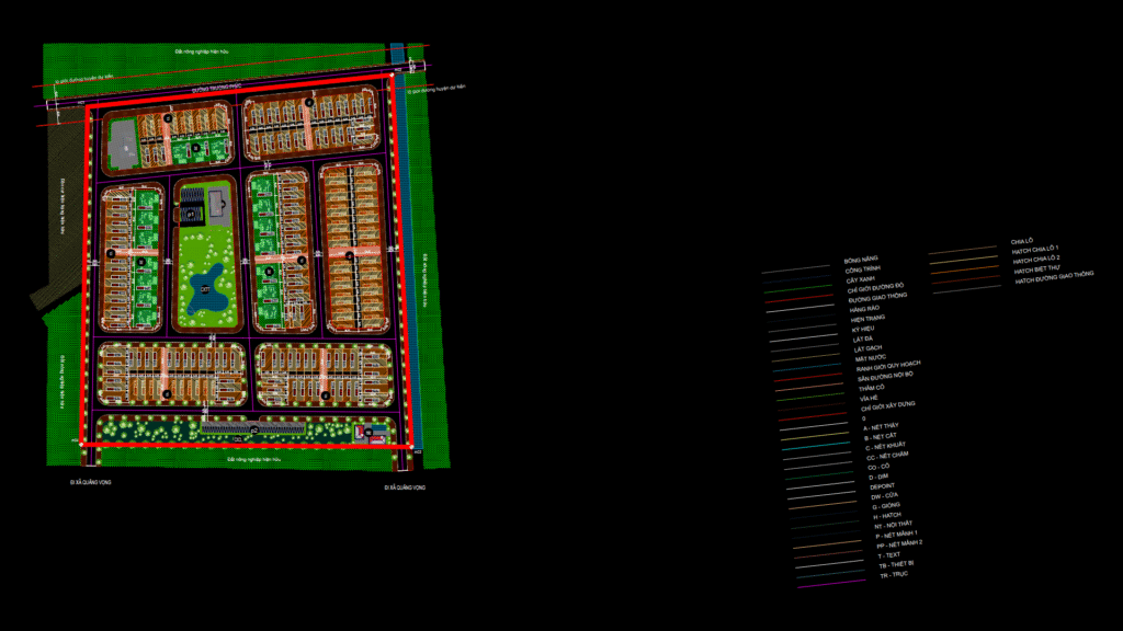
Comprehensive urban planning map for a residential development in Quang Ngoc township, Quang Xuong district, Thanh Hoa province. The plan covers 64,942.48 m² and features:
Housing Layouts:
– Row houses (designated as CL1-CL7) arranged in efficient blocks
– Single villas/detached houses (labeled BT1-BT3)
– Clear transportation network with interconnected roadways
Zoning Components:
– Central community green space with water feature
– Public cultural house (NVH) and community facilities
– Parking areas (P) distributed throughout teh development
– Buffer zones with landscaping along major roadways
The plan includes detailed boundary coordinates for land parcels, setback lines, and design regulations. Development is carefully integrated with existing agricultural areas and transportation infrastructure, including planned district roads. Technical specifications comply with Vietnamese urban planning standards with a focus on creating balanced residential neighborhoods with supporting community infrastructure.