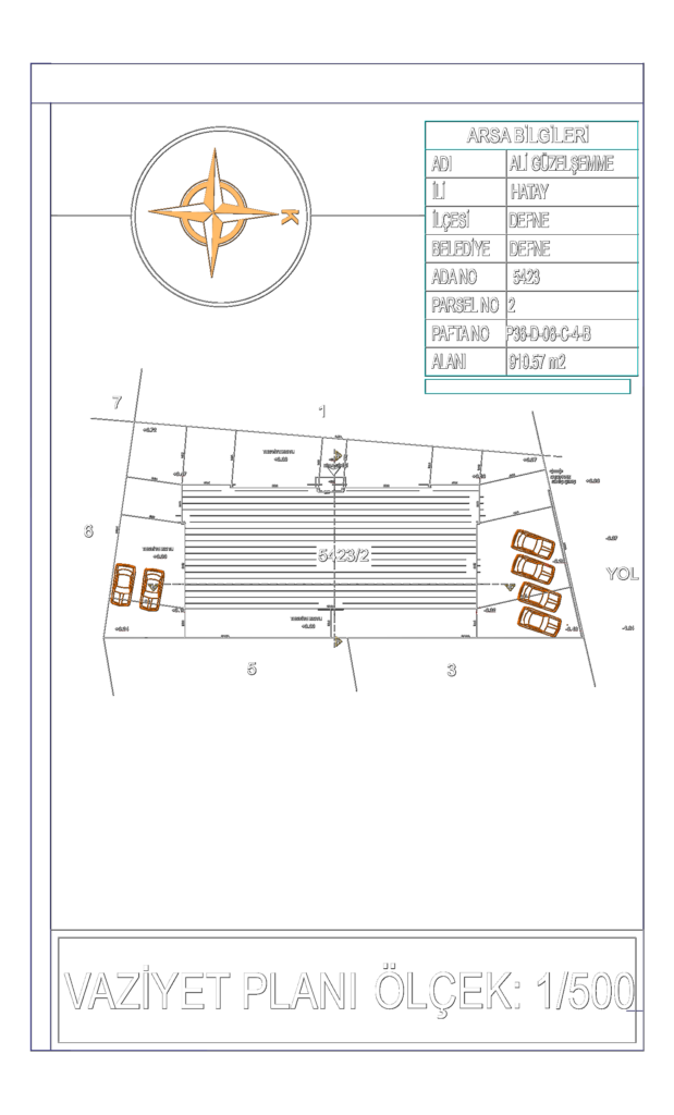
Site plan (Vaziyet Planı) for a 910.57 m2 plot in Hatay, Defne. It’s scaled at 1/500 and maps out the footprint for building 5423/2. I’ve included spot elevations throughput the site, ranging from +0.72 near the back down to -1.84 by the road. The drawing marks the main building entrance, parking stalls, and entry/exit points for vehicles. All the technical site info like parcel and block numbers is in the legend on the side. North arrow is clearly indicated.
Site Plan for a 910m2 Residential Plot CAD