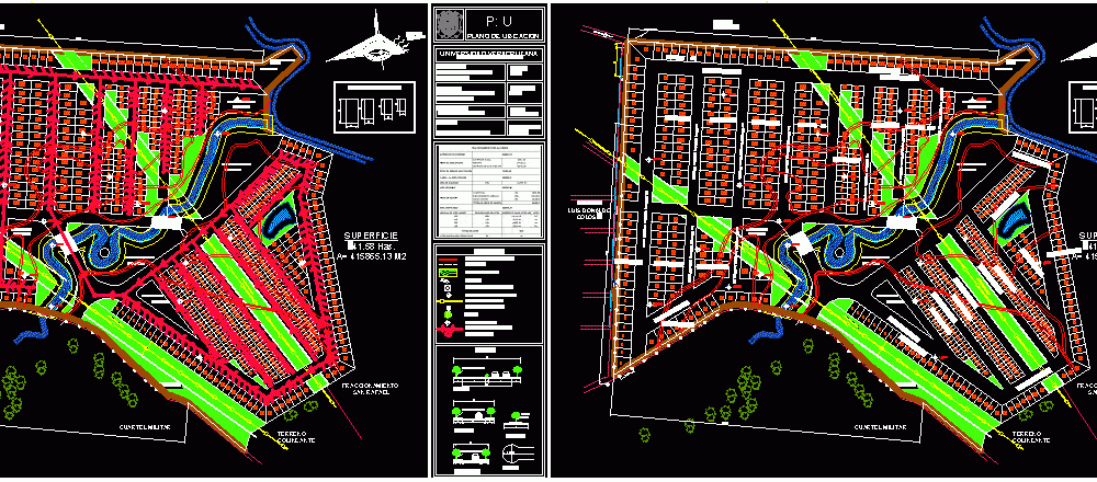
Subdivision Map–Coatzintla, Veracruz, Mexico DWG Block for AutoCAD
FIRST ORDER SUBDIVISION MAP IN COATZINTLA, VERACRUZ, MEXICO
Drawing labels, details, and other text information extracted from the CAD file (Translated from Spanish):
dominant winds, adjoining terrain, road diana laura, high tension lines, light pole, adjoining land, military barracks, main, collectors, feeders, returns, road, minimum, walkers, symbology, location map, p: u, university veracruzana, architecture fact, experience: urban design: new developments., catedratico: arq.jesus ceballos, elaboration: garcia xochihua wendy, dimension: meters, water treatment plant, commercial area, urban equipment, size of lots allowed, perimeter of the terrain., plots., level curves., reinforced concrete post., high voltage line, telephone pole, tree., level bank., stream, high voltage antenna, hydraulic installation, elevated tank, manhole, box Valve, primary distribution network, secondary distribution network, elevated tank, food line, apple i, apple ii, apple iii, apple iv, apple v, apple vi, apple vii, apple viii, apple ix, man zana x, manzana xi, manzana xii, manzana xiii, manzana xiv, manzana xv, manzana xvi, manzana xvii, manzana xviii, manzana xix
Raw text data extracted from CAD file:
| Language | Spanish |
| Drawing Type | Block |
| Category | Condominium |
| Additional Screenshots |
 |
| File Type | dwg |
| Materials | Concrete, Other |
| Measurement Units | Metric |
| Footprint Area | |
| Building Features | |
| Tags | apartment, autocad, block, building, condo, DWG, eigenverantwortung, Family, group home, grup, map, mehrfamilien, mexico, multi, multifamily housing, order, ownership, partnerschaft, partnership, subdivision, veracruz |
