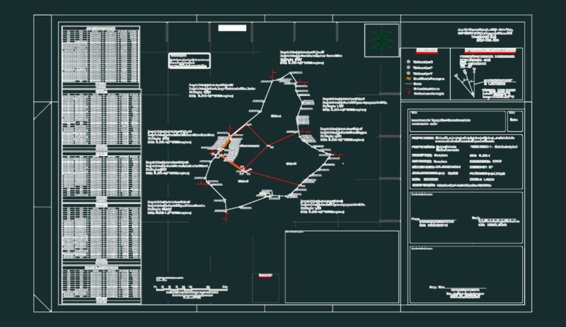
topo survey showing site boundaries, spot elevations, and building footprints. includes coordinate tables, legends, and notes in Hebrew.
Topographic Map & Plot Survey DWG CAD
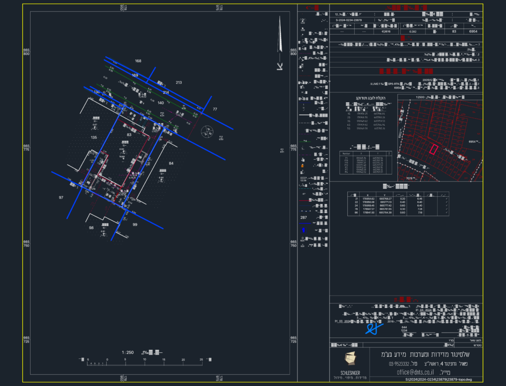
topo survey showing site boundaries, spot elevations, and building footprints. includes coordinate tables, legends, and notes in Hebrew.