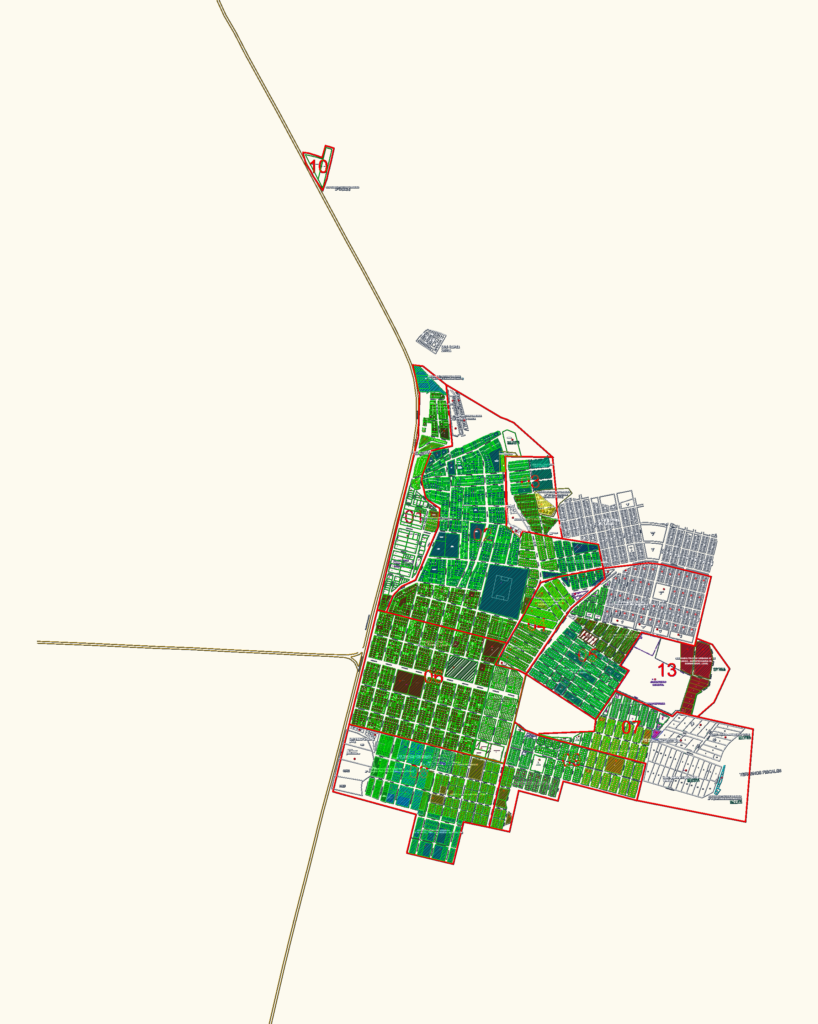
Cadastral base map covering the Tupac Amaru Inca area. Got the full sectorization, manzanas, lotting, and neighborhood boundaries like AA.HH. Vista Alegre & Dunas de Villa. Street names and zones for the cemetery and agricultural land are all mapped out.
Urban Cadastral Plan for Tupac Amaru Inca Sectorization DWG