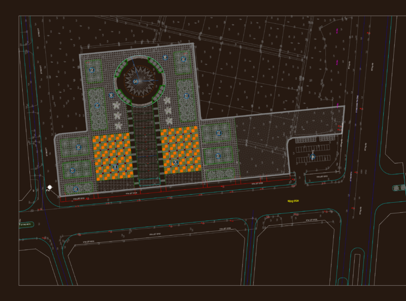
Urban Intervention Design
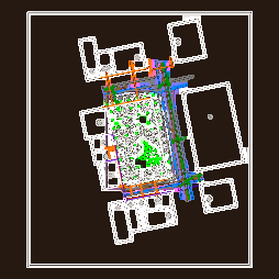
This site plan illustrates an urban pedestrian corridor design with integrated landscaping elements between parallel street grids. The drawing depicts a linear public space with distinctive red paving surfaces (approximately 6-8m wide) forming the main circulation path, complemented by green planted areas along its edges.
The design appears to be a public infrastructure intervention designed to connect urban blocks across multiple street intersections. The corridor runs north-south through an existing urban context, with surrounding buildings and street network clear and obviously delineated. Street names are indicated along the perimeter roads, helping situate the intervention within the city fabric.
Key features include:
– Organized tree placement along the walkway’s edges, shown with stylized circular symbols (referenced in layer ‘ARBOLES’ and block ‘tree_plan19’)
– Integration with existing street network at multiple crossings
– Contextual relationship with surrounding building footprints
– Clear delineation between hardscape (red) and softscape (green) elements
– Strategic positioning of vegetation to define spatial boundaries
The drawing uses a color-coded approach where the pedestrian pathway is emphasized in red against the surrounding urban context, creating a clear visual hierarchy that highlights the intervention’s role in improving pedestrian connectivity within the existing urban fabric.