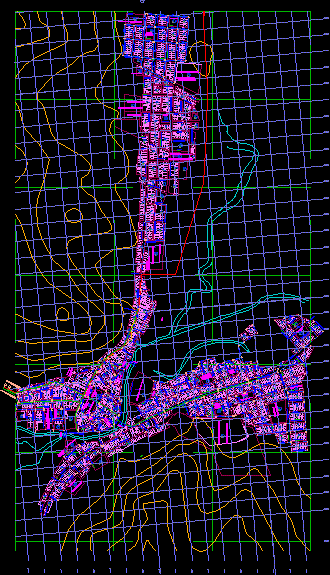
Cadastral and infrastructure map of Putina City featuring the urban drinking water distribution network. The drawing includes topographic contour lines, a coordinate grid, and the sectorization of city divisions.
This DWG file shows the layout of the water supply net across the urban area, overlaid on local terrain data. It is used for municipal planning, civil engineering projects involving water supply, and regional topographic studies. The plan details the city’s infrastructure division and sectorization. Red de agua potable.