Designs CAD
Categories
Upload
Pricing
Blog
FAQs
0
Login
Sign Up
Home
/
Public Facilities
/
City Plans
/
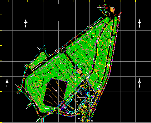
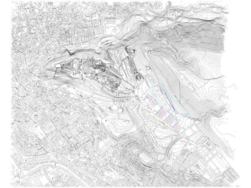
Field Of Marte DWG Elevation for AutoCAD
Field Of Marte DWG Elevation for AutoCAD
×
−
100%
+
Marte topographical elevation
FREE
File Details
File Type
DWG
Type
Elevation
Language
Other
Units
Metric
Uploaded by
CAD Drawings
Category
City Plans
Published
Apr 14, 2018
Free Download
Download File
Download faster, ad-free, with more daily files
from $7/mo
Tags
autocad
beabsicht
borough level
DWG
elevation
field
political map
politische landkarte
proposed urban
road design
stadtplanung
straßenplanung
topographical
urban design
urban plan
zoning
54m R.O.W. Urban Land Subdivision & Road Sections
FREE
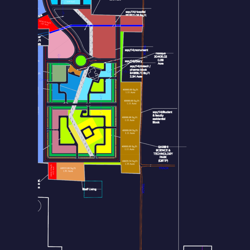
Qarshi Knowledge City QKC Muridke Master Plan
PREMIUM
$4.84
Duplex house plan
PREMIUM
$3.00
Industrial park master plan for Long Binh An
PREMIUM
$2.58
3D Wooden Leather Chair 3DS Model for 3D Studio Max
FREE
Super Mart Commercial Site Layout and Roadway Design Plan
FREE
Crushed rock road dwg
FREE
NGCP Power Line and Davao Cadastre Quarry Site Plan
FREE
Topographic Urban Layout Of Granada With Dedicated Truck Parking
FREE
1/500 Detailed Master Plan for Diem Dien Urban Plot ODT-8b
PREMIUM
$3.87
66m x 66m Administrative Building 3D Model
FREE
Browse All Downloads