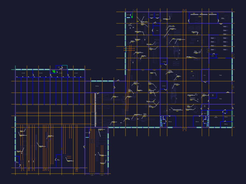
Detailed zoning and land use plan (1:2000 scale) for the Bau Bang Expanded Industrial Zone in Binh Duong Province, Vietnam. The plan designates specific areas for three industrial zone types with varying industrial functions and environmental impact levels. Key features include:
Infrastructure Elements
– Transportation network with clearly marked roads (N12-N22, D11-D14, NF15-NF17)
– Technical corridors for utilities with specified widths (1.5m-3.5m)
– Water channels and drainage systems with dimensions (B=2m-4m, H=3.5m)
– Electrical substations and protective corridors
Zoning Categories
– Industrial Zone Type 1: Electronics, IT, telecommunications, high-tech manufacturing
– Industrial Zone Type 2: Machinery, automotive, precision engineering with plating processes
– Industrial Zone Type 3: Textile, footwear, rubber, pharmaceutical, ceramic production
The plan includes detailed lot dimensions, areas in square meters, and elevation points with drainage specifications. Green spaces, service areas, and technical zones are integrated throughout the development with specific allocation percentages. Total development area exceeds 27,000m².