city-wide bike route map for Minneapolis based on the 1997 plan. covers existing and proposed trails, parkways, and commuter routes for the whole metro area. base map has streets, lakes, the river…
Minneapolis City Bike Routes 5 Year Plan DWG Map
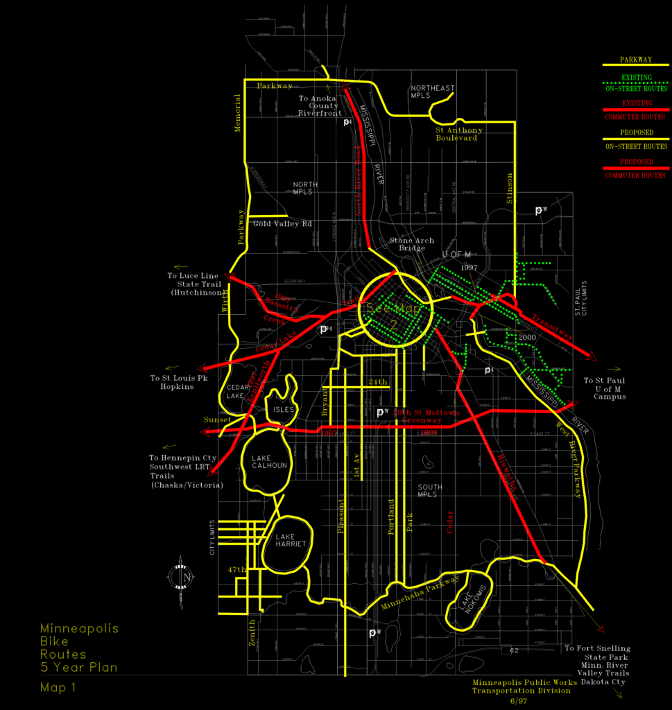
city-wide bike route map for Minneapolis based on the 1997 plan. covers existing and proposed trails, parkways, and commuter routes for the whole metro area. base map has streets, lakes, the river…