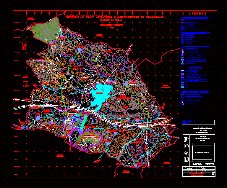
Urban planning master plan for the Timgad commune in Algeria at 1:25,000 scale. This PDAU (Plan Directeur d’Aménagement et d’Urbanisme) map details the spatial organization and regional infrastructure for the historical city and its surrounding environment.
The file includes comprehensive topographic contours, administrative boundaries, and hydrographic data featuring wadi networks and the Koudiat M’daouar reservoir. Structural axes and road networks are clearly defined, including national (R.N.) and regional (C.W.) routes. Specialized layers document energy and hydraulic networks, such as high-pressure pipelines and water supply lines.
Zoning data covers communal residential units, forest perimeters, and agricultural sectors. This technical drawing is used for regional land-use analysis and infrastructure planning. Révision du Plan Directeur d’Aménagement et d’Urbanisme de Timgad.