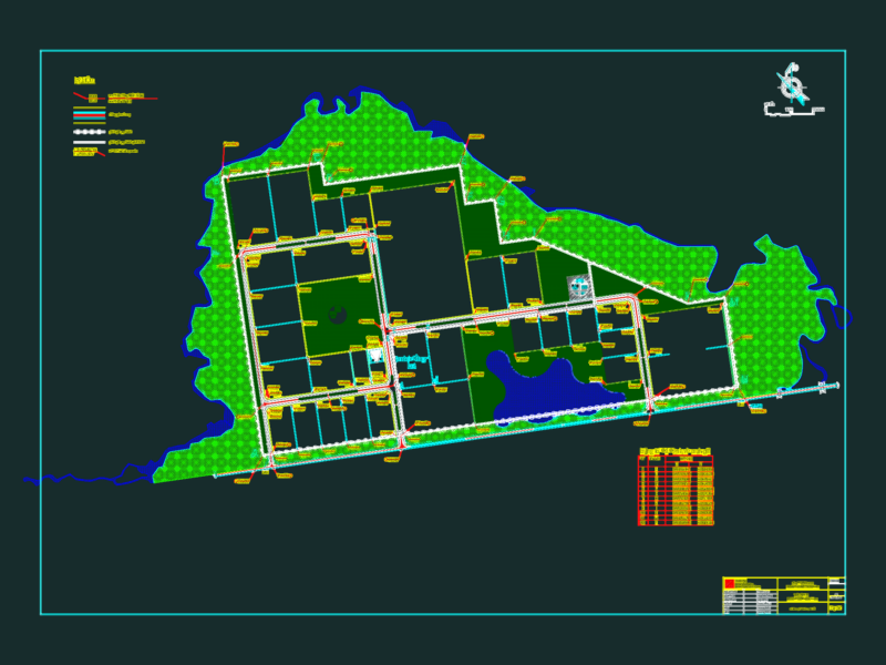
2D urban plan of Montería, Córdoba (Colombia), detailing the central city layout and Sinú river path. This DWG file provides a technical overview of the urban grid, including block-level lot boundaries (predios) and established street orientations.
The drawing identifies heritage conservation zones (patrimonio), municipal planning limits, and survey markers originally developed for the Plan Centro Montería. It includes coordinate grids and specific plot divisions for urban design, zoning studies, and regional mapping at a 1:2,500 scale. Plano urbano del centro de Montería.