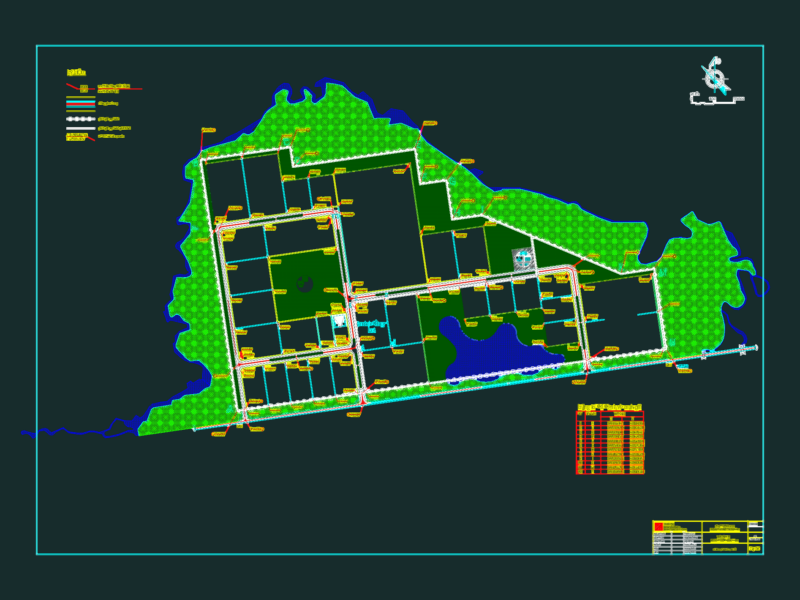
This topographic survey plan depicts the urban district of Pueblo Libre with detailed elevation contours and street layout. The drawing shows varied terrain with contour lines at consistent intervals, likely 1m or 0.5m, indicating the area’s topographic relief. Street networks are clearly delineated with property boundaries visible throughout the surveyed zone. A compass rose with cardinal directions (N, S, E, W, NE, SE, SW, NW) provides orientation reference. The plan includes several green spaces or parks integrated within the urban fabric. Notable elevation changes are evident in the northwestern portion where contour lines cluster more densely, suggesting steeper gradients. This survey would serve as essential documentation for urban planning, infrastructure development, drainage design, or construction projects within the Pueblo Libre district. The comprehensive topographic data enables accurate volumetric calculations and site analysis for engineering applications.
Topographic Survey Plan of Pueblo Libre Urban Area with Contours