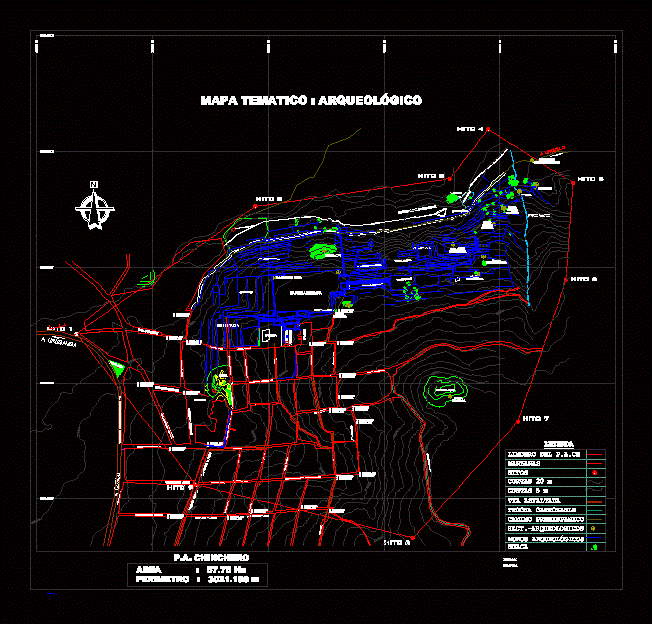
The map of Chinchero in the Urubamba Valley; department of Cusco; placing the most important sights.
Drawing labels, details, and other text information extracted from the CAD file (Translated from Spanish):
pach.-zon, scale :, date :, location: p. to. ch., district: chinchero, province: urubamba, department: cusco, antrop. raul pacheco herrera, regional direction of culture cusco, dr. david ugarte vega rye, plane no., thematic map, zoning, national institute of culture regional direction of culture – cusco, technical office of elaboration of instruments of management in patrimony master plan of the archaeological park of chinchero, regional direction of culture cusco, a cusco, a urubamba, thematic map: zoning, urquillo, boundary of the pach, apples, landmarks, asphalt road, carriage trail, prehispanic road, salaqata, usphapata, kayllapata, street simon bolivar, kantu chaca, rumiñahui, sandowaskana, chuspichaca, pampahuasi, charquimachay, tekana qantu, conquista street – cononapata, garcilaso avenue, manzanares street, saqarara street, cahuide street, rumiñahui street, simaccuchu street, nazareth street, qollana street, temple, sochu cuchu street, qoripata street, conquista street, parking, atria del, parqowayqo, caminodeherradura, waka condorqaqa, quillapata, yanaqaqa, munaypata, wata ycarcel, patapatayoq, via asphalted chinchero – urubamba, plaza, capellan pampa, qente pata, huaca kusilluchayoq, huaca condorqaqa, pachanpujio street, manco second street, panel inc, oxidation well, chincana, simacucho, huk’uchahuaylla creek, huaca teteqaqa, teteqaqa platforms, huaca pumaqaqa, huaca salaqaqa, planimetry work, photogrammetry and geodesy, digital teledetection photogrammetry area: ing. reystvan torres berrio, geodesy area: ing. hector acurio cruz ing. nexon mora carrillo, p.a. chinchero, sacapellan pampa, concordia condorqaqa, huaca, qentepaqa, hornacinas of patapatayoc, huaca sector chincana, qhapaq ñan, inca bridge, qapaq ñan chinchero urquillo, archaeological sites, archaeological walls, utp – i, utp – ii, utp – iii, archaeological zone, historical area, archaeological reserve area, thematic map: archaeological, graphic, qhapaq ñan chinchero urquillo, sect.-archaeological