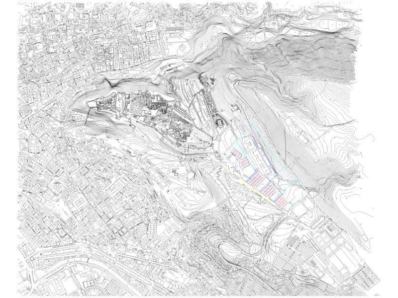
Comprehensive land use master plan for a development area in Thanh Hoa City, Vietnam. The plan delineates various zoning categories including residential areas (villa plots BT1-BT30, linked houses LK1-LK150), mixed-use developments (HH1-HH7), commercial service zones (TMDV1-2), social housing (NOXH1-4), relocation housing (TDC1-8), public facilities (CC1-16), educational institutions (GD1-10), transportation infrastructure, green spaces (CX1-57), and water bodies. Key features include:
Zoning Categories:
– Residential zones with villa plots and row houses
– Public facilities and community service areas
– Green spaces and recreational areas (TDTT1-5)
– Educational facilities (schools and training centers)
– Religious and cultural heritage sites
– Transportation networks connecting to Thanh Hoa City center, Ninh Binh, and Hoang Long Industrial Zone
– Water bodies and landscape features
The plan incorporates infrastructure components including pumping stations, technical infrastructure hubs (HTKT1-5), and cemetery zones (NT1-6). Boundary demarcations and development parameters (building heights, lot coverage percentages) are specified for each land parcel.