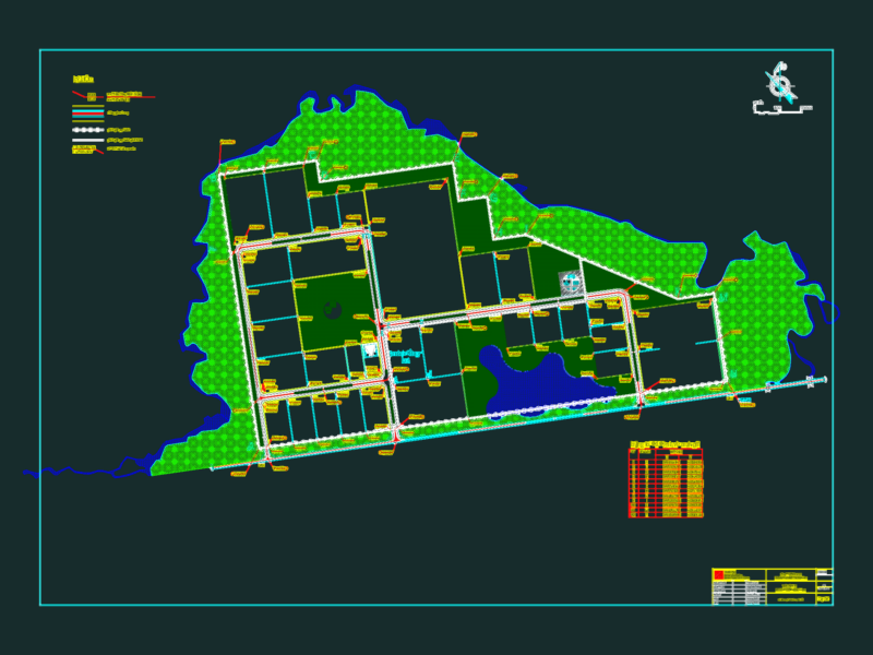
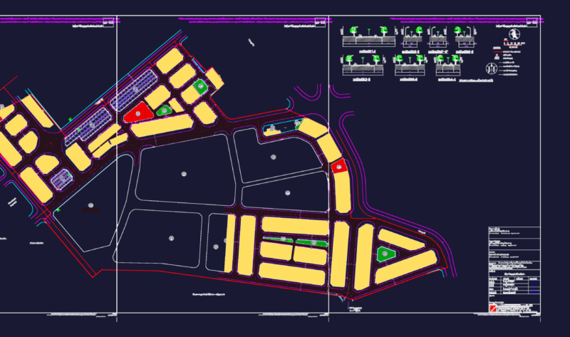
2D AutoCAD drawing of the general urban plan for the Chimbote district in Peru. The file features a comprehensive top-view map of the city’s layout, showing residential blocks, major road networks, and the coastline. It functions as a base map for regional planning and urban design studies.
The map includes a compass rose and uses color-coded hatching to differentiate urban sectors and zoning areas. This resource provides a foundation for site analysis and metropolitan development projects within the Chimbote region. Plano general del distrito de Chimbote.