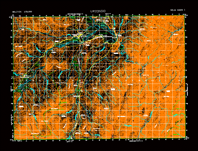
6628I Location: Bolivia Tarija Uriondo contour
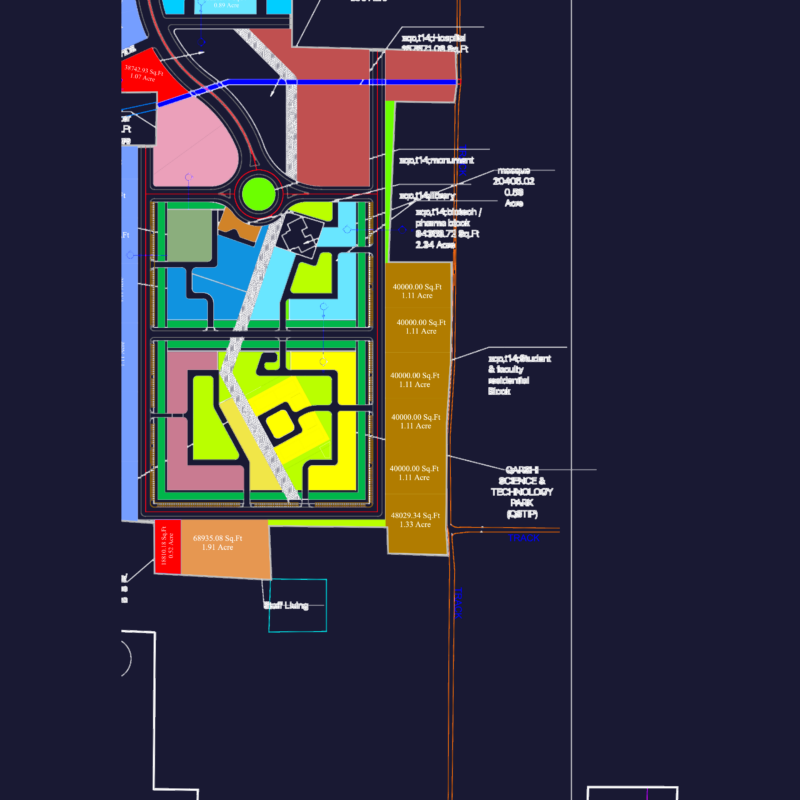
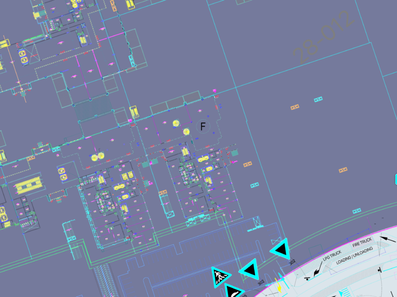
Drawing labels, details, and other text information extracted from the CAD file (Translated from Spanish):
stay, ruin, stay, chorrillos, stay, ancon, the hut, stay, gust, community, hillside, stay, potato chakra, community, angostura, calamuchita, stay, the FIG tree, stay, north coloni, stay, company, stay, St nicolas, chocloca, stay, coloni sud, comity, canyons, tunal stay, stay, little valley, stay, hills, community, canyons, stay, canyons, stay, guaranguay, stay, Basque countryside, stay, strong boy, stay, mezon, stay, huayrihuana, bm., bm., cemetery, generator station, church santiago, soccer field, school delfin pine echazu ‘, soccer field, cemetery, basketball court, guaranguay school, cemetery, basketball court, school nucleus francisco uriondo, chapel of rosary, soccer field, lime oven, soccer field, ford, fords, telegraph line, hill ancon, hill county, hillside, hill stairway, hill high lagoon, hill apacheta, hill khasa, skinny hill, hill bramadero, hill vilayo, hill huacankhi, hill huacaral, Cerro boilers, hill saladillo, soccer field, stay, rincon ulalayu, agricultural extension, reforestation, fords, sheet, bolivia, uriondo, crossing road tarija ventolera km., stay great fort km., padcaya km., stay san jose km., together km., km., uriondo, cemetery, stay, vina pampa, stagnation patanchada km., stay, half Moon, area of, culture, sandy, culture, culture, growing area, area of, culture, sandy, area of, culture, growing area, sandy, growing area, sandy, culture, area of, culture, mount tall, culture, area of, culture