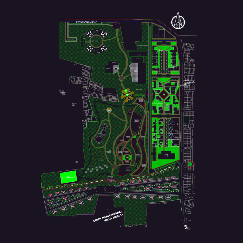
Comprehensive land use and functional zoning plan for Co Le Township in Truc Ninh District, Nam Dinh Province, Vietnam at 1:5000 scale. The drawing shows detailed allocation of urban areas with specific land use designations including residential zones, public facilities, educational institutions, healthcare facilities, commercial areas, industrial land, green spaces, transportation networks, and water bodies.
Key Components:
– Total planning area: 208.06 hectares (with future expansion to 282.07 hectares) – Administrative facilities: Government offices, police stations, post office – Educational facilities: High schools, secondary schools, primary schools, kindergartens – Healthcare: District hospital, health center, medical station – Commercial areas: Markets, service, basically, areas, transportation terminal – Religious and cultural sites: Temples, cultural houses, monuments – Technical infrastructure: Roads, bridges, utility networks The plan includes specific development parameters for each zone such as building density percentages, maximum building heights, green space ratios, and land use coefficients. Transportation corridors connect to neighboring communes including Phuong Dinh, Trung Dong, and Liem Hai.