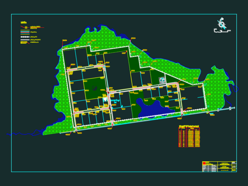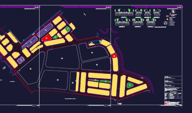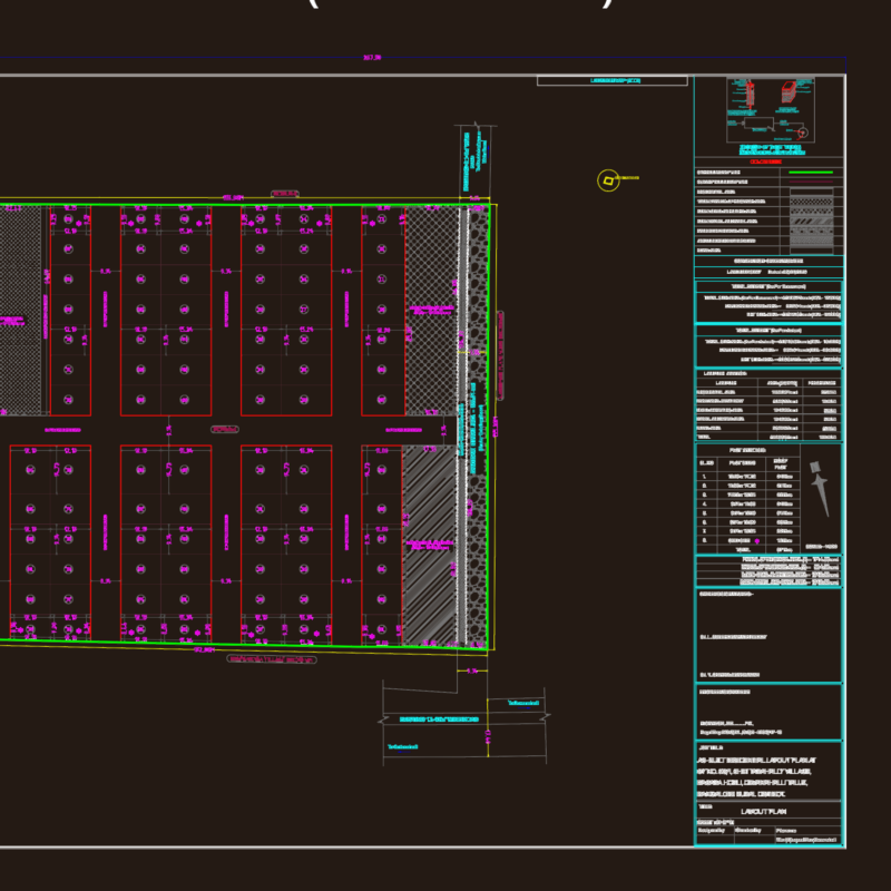
Correction plane Catambuco district of the department of Narino Colombia
Drawing labels, details, and other text information extracted from the CAD file (Translated from Spanish):
sandpit, gardens cemetery christ king, hacienda chaves, rio miraflores, basketball court, drain tanks, rio miraflores, empodite aqueduct, military base chapalito third brigade, lantern motel, chapalito park, rio miraflores, the walls, aqueduct tank, broken chapalito, rio miraflores, gardens cemetery christ king, san ezequiel path, villa isabel, military base chapalito third brigade, hacienda chapal, broken chapalito, brick wall, cemetery, jongovito, community House, power transmission line, aqueduct tank, crops, aqueduct pipe, the josefina, slaughterhouse beautiful, grass, Armenian mine mine, grass, brick wall, jongovito trade fair place, ponds, vereda botanilla, broken catambuco, grass, Armenian treasury, aqueduct tank, power transmission line, the josefina, san ezequiel path, the hope, crops, aqueduct tank, crops, soccer field, grass, the josefina, neighborhood jongovito, public space occupation, constructions in projection. vials, narrow narrow streets, uncontrolled brick sheds, complementary basic infrastructure, rec. public, cemetery, raul thin warrior, mayor, pablo andres guerrero perez, administrative department of municipal planning, director, p.o.t., marco antonio benavides lopez, deputy director of urban planning, alvaro german enriquez solarte, dapm, normative sheet of catambuco botanilla, scale, Map, archive, san juan de pasto sep., date, base map, generalities: the territory of the corregimiento of catambuco belonged the encomienda assigned by the Spanish crown diaz sanchez of initially with tributary tribes distributed in the lands of high tillage this territory was scene of the last fights against the republicans who supported the king fernando vii towards the year the rural catambuco headwaters are located within the corregimiento of the side side of one of the most important road axes of the valley as is the Pan-American highway which connects them with the city of the rest of the central region south of the department this location favors in some way its spatial physical development allows the location in its territory of facilities such as coffee processing factories of products outlining the place as an area for the commercial use of concentration of rural production. from the point of view part of the territory is part of the national natural park environmental situation that potentiates it as a space for ecotourism other recreational activities for both residents and visitors. the topography is mostly flat slightly favorable situation for the development of the agricultural sector in addition the lands are supremely fertile because they are made up of volcanic ash by a thick vegetative layer that allows the cultivation of a variety of high quality products. in the urban development of the centers these are framed by three ways that converges