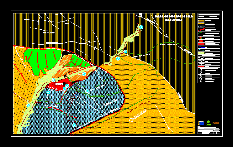
Geomorphological map of the region Moquegua –
Drawing labels, details, and other text information extracted from the CAD file (Translated from Spanish):
Office of, humanitarian aid, European Comission, oxfam, you predes, study center, disaster prevention, you predes, symbols, description, Andean flank, legend symbology, mudslides, ejection cones, active geodynamic expressions, landslides, alluviums, s.p., local slope, regional slope, micalaco failure, thorata fault, micalaco failure, disability failure, miss seven laps, jaguar failure, Andean flank, s.p., problematic soils, coastal plain, major morphostructural units, river terraces, Upper level:, coastal plain, lower level:, structural depression, from moquegua, watershed limit, local geoforms, erosion amphitheater, moquegua, rivers, broken, structural elements, regional failures, failures, inferred failure, escarpment, cultivated valley, erosion of banks, floods, moquegua, qda. cemetery, qda. montalvo, qda. pink breast, mammoth basin, geomorphological map, moquegua, risk vulnerability of moquegua district, study, development of local capacities to prevent disasters in vulnerable earthquake communities, sheet:, area of moquegua, geomorphological map, description:, draft, drawing cad:, a. walls rooms