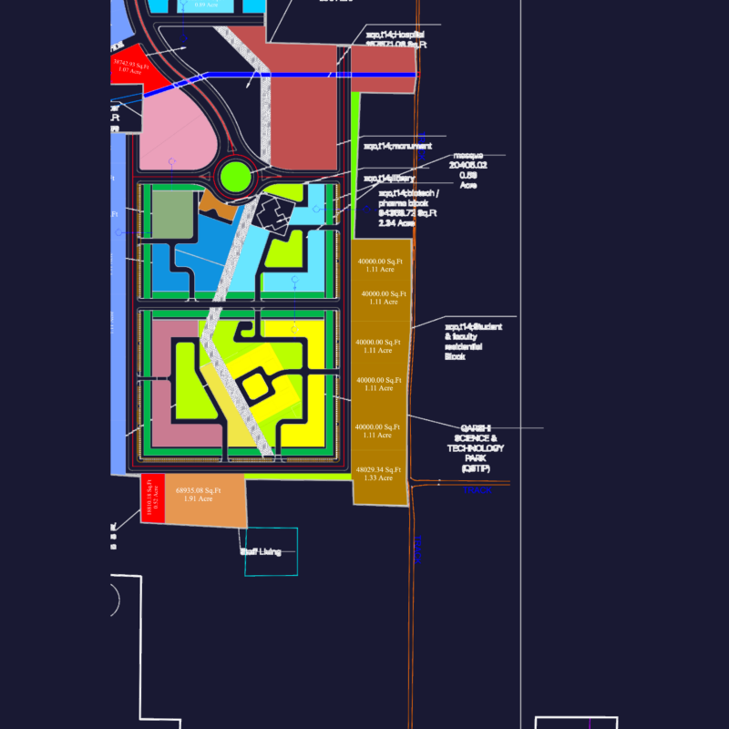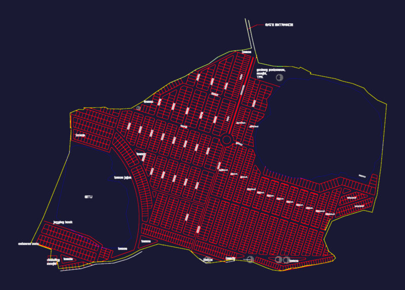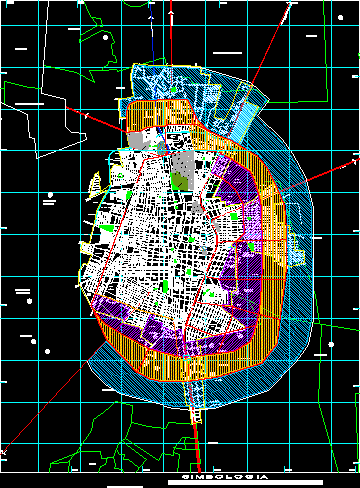
Matehuala urban development plan showing growth projections and land use zoning. The drawing illustrates concentric expansion buffers around the city core, categorizing areas for industrial use, green space, and residential development. It includes a detailed street network with labeled avenues, boulevards, and federal highways.
Infrastructure details include the railway system, central bus station, municipal stadium, and aqueducts. The plan also locates parks, the Pantheon cemetery, and specific landmarks like the lienzo charro arena. A technical symbology legend defines urban limits, ejidal boundaries, and state highway routes. The file utilizes a coordinate grid system for spatial orientation and site planning. Plan urbano de crecimiento.