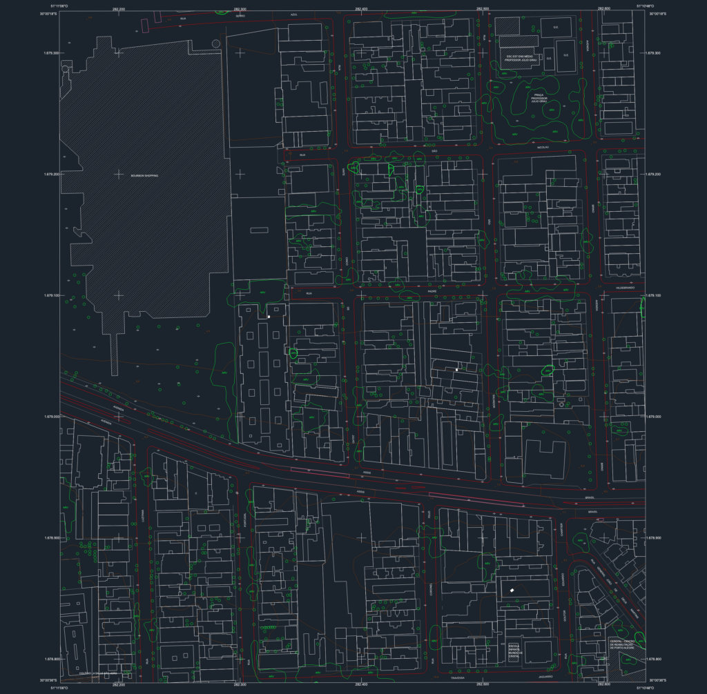
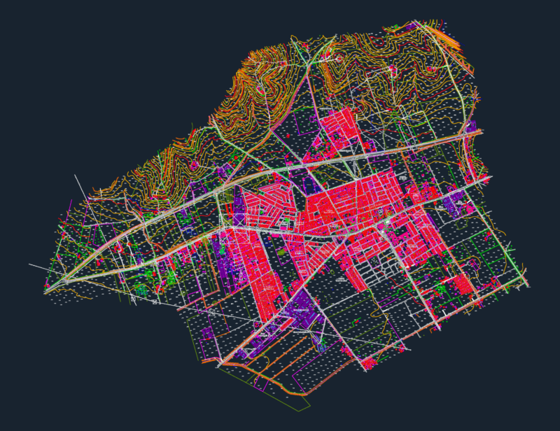
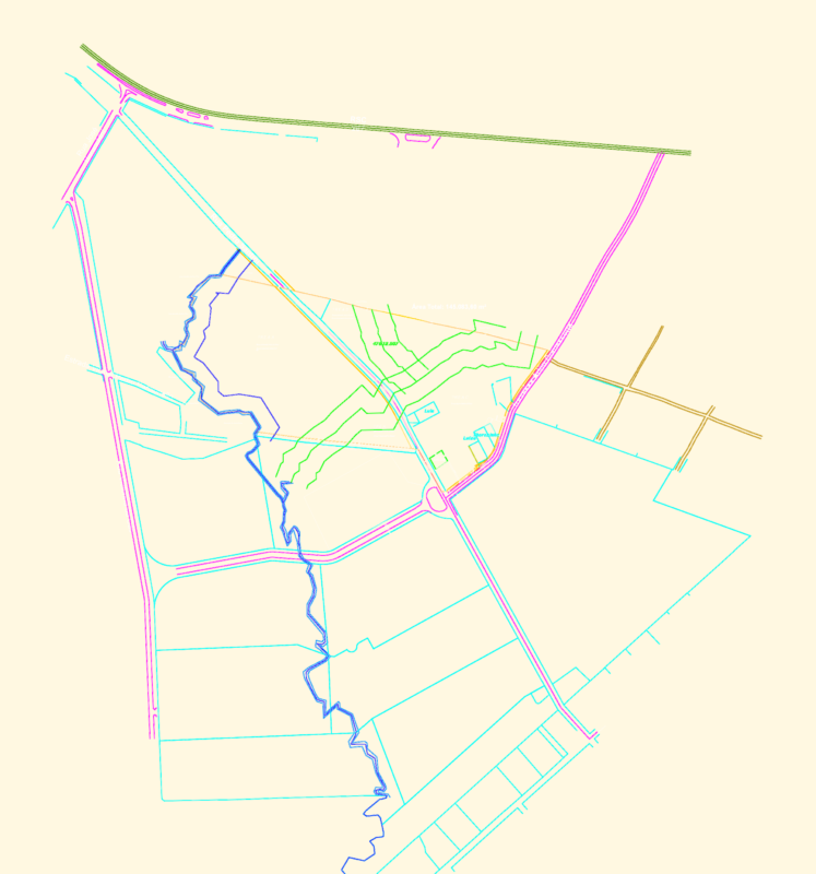
Detailed urban map of a section of Porto Alegre, Brazil, centered around the Bourbon Shopping area. Includes building footprints, street layouts, and topography with 1-meter interval contours. Map is scale 1:1,000 and follows the SRIGAS 2000 geodetic system. Carta planialtimétrica detalhada de Porto Alegre. Contém edificações, arruamento e curvas de nível.
Porto Alegre Urban Map DWG with Topography and Infrastructure