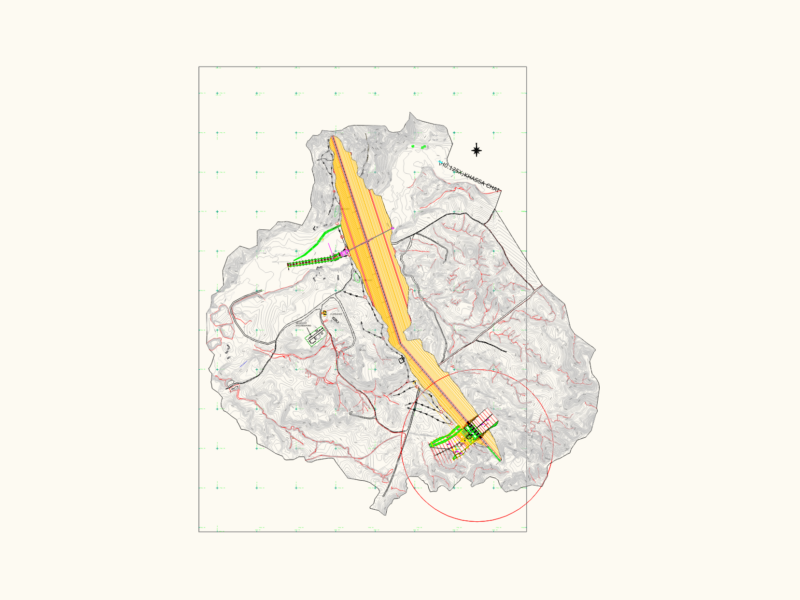
Alignment survey for a logging road spanning over 12km, featuring major and minor topographic contours at defined intervals. Drawiing includes stationing every 20m (typ.) with specific layers for weighbridge utilities, topsoil stock areas, and parking bays. Map data covers creek & river locations and boundary setbacks for IPPKH compliance
Road alignment survey with topographic contours and stationing detail