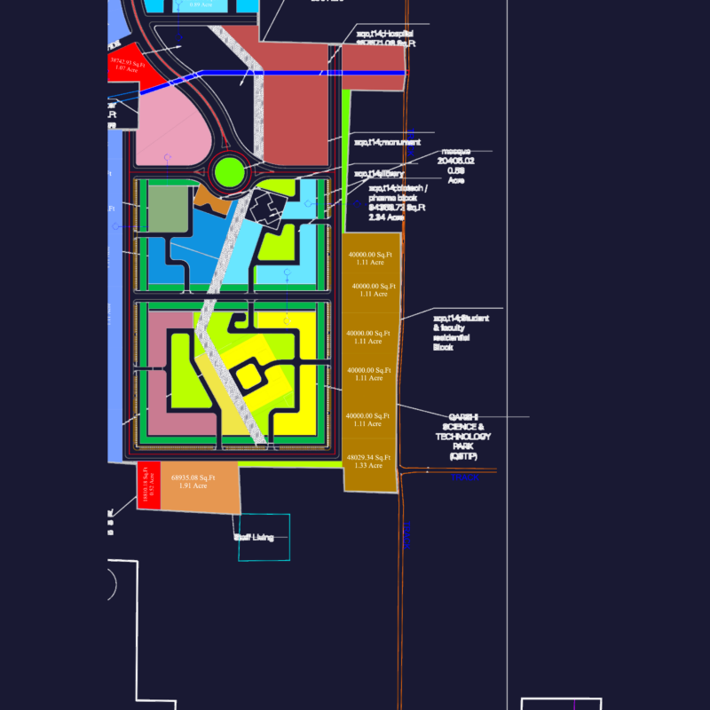
PLAN APPROVED BY SECRETARY OF PUBLIC WORKS OF MEXICO STATE GOVERNMENT.
Drawing labels, details, and other text information extracted from the CAD file (Translated from Spanish):
road pachuca cd. Sahagun, Mr. celerino bathrooms, ejido of pachuquilla, damping, access surface has., have, fracc. big ranch, railroad track, right of way, private property, fracc. big ranch, sup, sup, green area, sup, green area, area of equipment, private property, area of equipment, area of equipment, home, Saint Thomas Circuit, tezoantla circuit, carlos circuit, circuit tecanecapa, street maguey white, alfajayucan street, caraballo street, mazatepec street, san mateo street tlajomulco, benito juarez street, street el contadero, street the estanzuela, san sebastian street, street mixquiapan, street the goldfinch, street reform, huajomulco circuit, street otomulco, donation area, palm thick circuit, av. brushes, av. corner of the water, avenue la higa, avenue la paz, xochihuacan Avenue, av. corner of the water, circuit tecanecapa, street lopez mateos, street orchard girl, av. corner of the water, green area, green area, road pachuca cd. Sahagun, san aparicio circuit, first stage