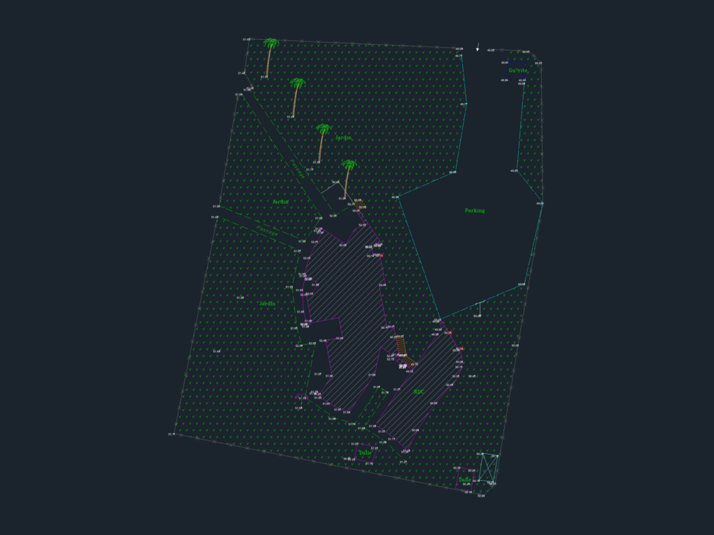
Topographic site survey and landscape layout at 1:200 scale for a property in the Berrechid province of Morocco. This metric DWG plan includes spot elevations across the entire site, detailing garden zones (espace vert), parking areas, and existing structures such as concrete slabs (dalle) and temporary sheds (baraque).
The drawing contains specific symbols for palm trees, low-voltage utility poles, street lamps, and water supply manholes. Boundary details include barbed wire fencing and concrete borders. It is formatted as a technical land survey for site analysis, urban design, or landscape planning. Plan côté avec repères topographiques.