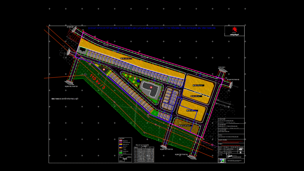
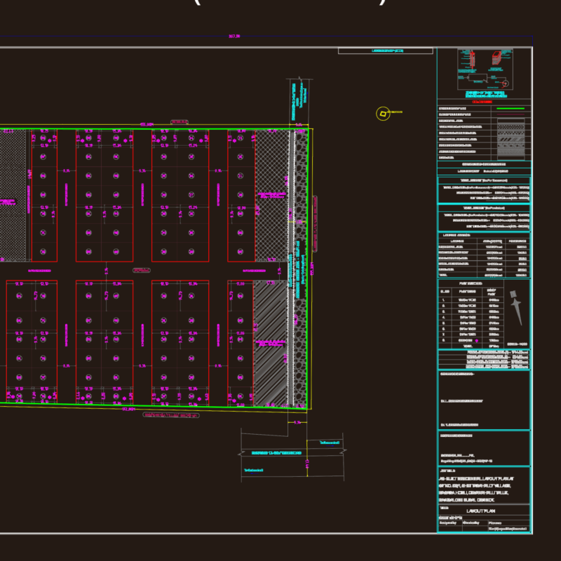
A detialed urban development master plan for the OM19 residential area located south of QL45 in Rung Thong town, Dong Son district, Thanh Hoa province. The plan is drawn at 1:500 scale and shows spatial organization of architectural and landscape elements. The development is divided into multiple residential blocks (labeled LK1, LK2, LK3) with individual lot dimensions precisely marked. The plan includes infrastructure elements such as a 110kV power line corridor, transportation network with both existing concrete roads and planned new roads, green spaces, and community facilities. The drawing includes coordinate reference points in VN2000 system with nine boundary markers (M1-M9) precisely positioned. The design incorporates existing topographical elements with elevation points ranging from approximately 3.0m to 6.5m, and features drainage systems, irrigation canals, and landscape elements.
Urban Development Master Plan for OM19 Residential Zone, 1:500 Scale