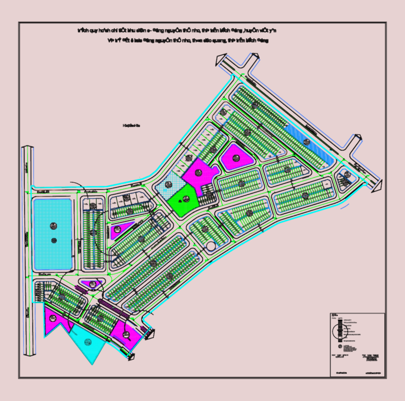
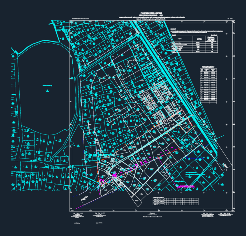
Comprehensive topographic survey plan of an urban area showing detailed utility infrastructure and terrain features. This plan includes street layouts (Sovetskaya Street, Chekhov Street), building footprints with structure types (KN, KZh indicating concrete structures), utility networks (water supply, sewage, electricity), and elevation data. Notable infrastructure elements include transformer substations (TP32A, TP34), various pipeline systems (cast iron 100-400mm, concrete 400-500mm), manholes with elevation marks, and electrical lines (0.4kV, 6kV). Elevation points range approximately from 1.5m to 28m, with contour lines defining the terrain relief. The survey captures both underground utilities and aboveground structures with coordinate reference points for precise positioning. Various vegetation and landscape elements are represented using standardized symbols on dedicated layers.
Urban Topographic Survey Plan with utility Networks & Infrastructure