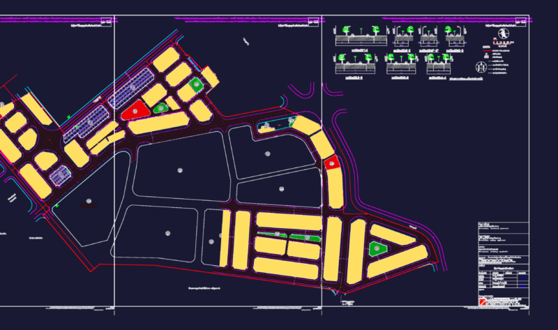
Cadastral plane of Yabroco –
Drawing labels, details, and other text information extracted from the CAD file (Translated from Spanish):
and sweet, populated center, Tarucachi, tarata, traditional village, stretch pampa, district of, susapaya, town, stretch, Stretch river, susapaya, q. suquillani, chucatamani, gun pistol, location map, scale, populated center, susapaya, populated center, sitjara, populated center, ticaco, populated center, province of, susapaya, and sweet, populated center, Tarucachi, tarata, traditional village, stretch pampa, district of, susapaya, town, stretch, Stretch river, susapaya, q. suquillani, chucatamani, gun pistol, location map, scale, populated center, susapaya, populated center, sitjara, populated center, ticaco, populated center, province of, tarata, tacna street, education, and sweet, populated center, general table of areas, legend, symbol, description, lots registered in the real estate register, which will be transferred to the urban land registry, equipment, total mz, living place, total, total, area chart, of apples lots, total, mza., lt., area, square, circulation area, gross area, complementary services, communal services, education, Health, housing area, public recreation, total area of urban equipment, floor area, description, partial, partial area, total area, general, peasant community, land owned by, from yabroco, peasant community, land owned by, from yabroco, peasant community, land owned by, from yabroco, peasant community, land owned by, from yabroco, peasant community, land owned by, from yabroco, peasant community, land owned by, from yabroco, peasant community, land owned by, from yabroco, peasant community, land owned by, from yabroco, peasant community, land owned by, from yabroco, peasant community, land owned by, from yabroco, Health, education, Health, communal services, communal services, square, communal, services, communal services, education, polo street, passage, polo street, passage, cahuide street, san martin street, passage, san martin street, passage, cahuide street, street santa cruz, Street, cahuide street, passage, tacna street, puno street, passage, puno street, street candarave, passage, Street, tacna street, Street, mza., lt., area, mza., lt., area, mza., lt., area, mza., lt., area, mza., lt., area, mza., lt., area, mza., lt., area, mza., lt., area, mza., lt., area, mza., lt., area, mza., lt., area, mza., lt., area, mza., lt., area, variable, section, sidewalk, track, scale:, sidewalk, section, sidewalk, scale:, sidewalk, scale:, section, scale:, section, garden path, batch servant, total, dominant lot, easement of passage, scale, batch apple, detail, detail, passage, zone