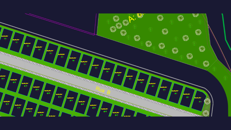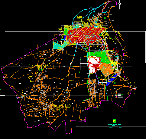
2D CAD drawing showing the urban layout and zoning for Ciudad Sandino and the surrounding Managua metropolitan area in Nicaragua. The plan includes detailed land-use classifications for traditional neighborhoods, progressive urbanizations, residential villas, and spontaneous settlements. It identifies specific commercial centers, market areas, and the industrial sector surrounding the Esso refinery.
The map outlines the regional road network, including the Carretera Managua-Corinto, the New Leon road, and the route to Xiloá. Infrastructure details include water tank locations and municipal boundaries. The file covers areas such as La Trinidad, Cuajachillo, and Los Brasiles, providing a technical overview of the Leal Villa district with a color-coded symbology for urban planning. Simbología de zonificación urbana para Ciudad Sandino.