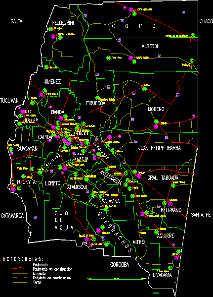
IS A MAP WITH THE MAIN ROADS DEPARTMENT AND THE PROVINCE OF SANTIAGO DEL ESTERO IN ARGENTINA
Drawing labels, details, and other text information extracted from the CAD file (Translated from Spanish):
sachayoj, pampa of the guanacos, Earth, enripiado under construction, enrapiado, pavement under construction, pavement, to symbolize, estero, of the, Santiago, tomas young, feminine, one year old, real sayana, malbran, July sun, will kill, lugones, villa salavina, juliana chilca, its T. atamisqui, laprida, choya, go the tip, taboada station, forres, beltran, vilmer, deep, season symbol, clodomira, flag lowered, the puddle, jungle, water bottle, sumampa, go unit, flag, añatuya, quimili, cold, herrera, the looms, go to the woods, shoots, vºsan marin, pit pit, heron, suncho corral, fernandez, the glen, the band, deep River, san pedro, deep well, new Hope, tinkle, bobadal, the mojon, rooster field, burnt mountain, figueroa, gral. taboo, avellaneda, alberdi, Brown, juan felipe ibarra, aguirre, miter, rivadavia, capital, band, Guayana, salavina, taco well, Alpine colony, pellegrini, jimenez, loreto, atamisqui, belgrano, jumps, Tucuman, chaco, Santa Fe, Cordova, catamarca