Topography – Bathymetric – Plant Dam DWG Block for AutoCAD

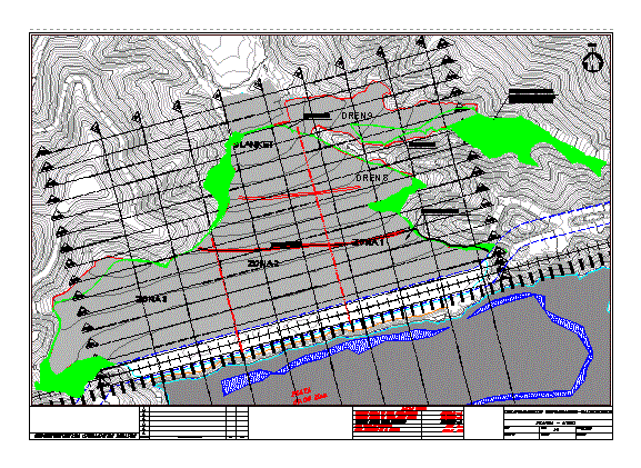
In this paper we have a topography batimetric acon their respective courts besides the dike of a plant and the dam reservoir with all its dinning; water flows, volume of sand; volume of batter; etc
Drawing labels, details, and other text information extracted from the CAD file (Translated from Spanish):
nm, description of revision, revision, date, superintendence operations tailings, plant – reservoir, scale, drawing nuber, drawin by, approved, checked, ——, topographic-bathymetric survey, total contact area, beach area , data of bathymetry, water volume, volume slats, has., legend, surface month of August, surface month of July, detail crest, plant – wall, average level on the crest, data wall, volume sands upstream slope, volume Total sands produced, profiles parallel to the axis, surface July, surface, August, blanket, previous location, year, projected volume, volume deposited, water level, levee level, freeboard, security, over wide, monthly presentation, advance line per month June, advance line to May, tailings discharged reservoir, surface August, talud month of June, slope month of July, valley east, central valley, area next to surfacing beach, blanket, beach, pending sectors for, coating of sands, unloaded sands, slope
Raw text data extracted from CAD file:
| Language | Spanish |
| Drawing Type | Block |
| Category | Handbooks & Manuals |
| Additional Screenshots |
|
| File Type | dwg |
| Materials | Other |
| Measurement Units | Metric |
| Footprint Area | |
| Building Features | |
| Tags | autocad, block, courts, dam, DWG, paper, plant, respective, topography |


