Barranco Cadastral Plane DWG Block for AutoCAD
ADVERTISEMENT
ADVERTISEMENT
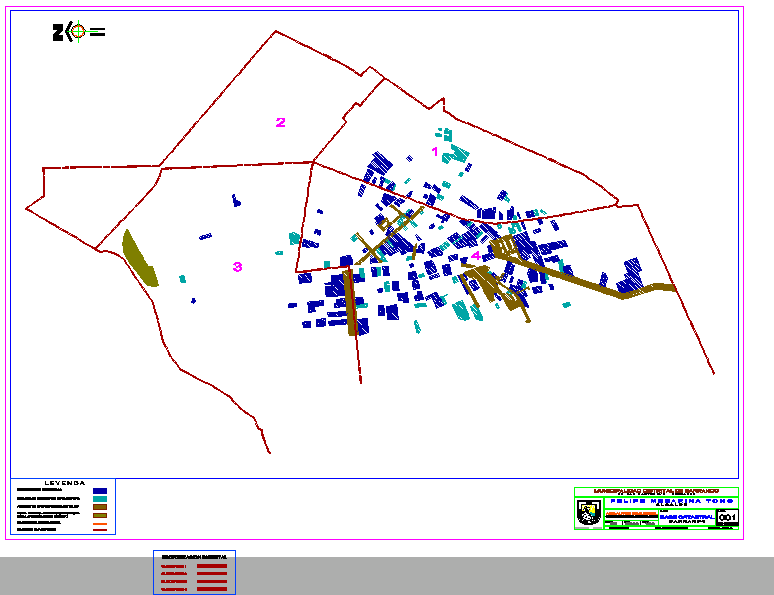
Barranco Cadastral Plane
Drawing labels, details, and other text information extracted from the CAD file (Translated from Spanish):
city development manager, arq. alfred silva meinel, district municipality of ravine, ravine, drawing, nfbe, scale, date, January, flat:, sheet, datum: psad, sist. of projection: utm, territorial jurisdiction of ravine, pen, municipality of ravine, municipal, rancho, Pub, manager of city development environment, arq. alfred silva meinel, district municipality of ravine, cadastral base, n.f.b.e., July, archaeological area, monumental area boundary, special regulatory area, monumental urban environments, buildings of monumental interest, historical monuments, quadrant, district sectorization, quadrant, limit of quadrants
Raw text data extracted from CAD file:
| Language | Spanish |
| Drawing Type | Block |
| Category | City Plans |
| Additional Screenshots |
|
| File Type | dwg |
| Materials | |
| Measurement Units | |
| Footprint Area | |
| Building Features | |
| Tags | autocad, barranco, beabsicht, block, borough level, cadastral, DWG, plane, political map, politische landkarte, proposed urban, road design, stadtplanung, straßenplanung, urban design, urban plan, zoning |
Related Products

Same Contributor


Featured Products


