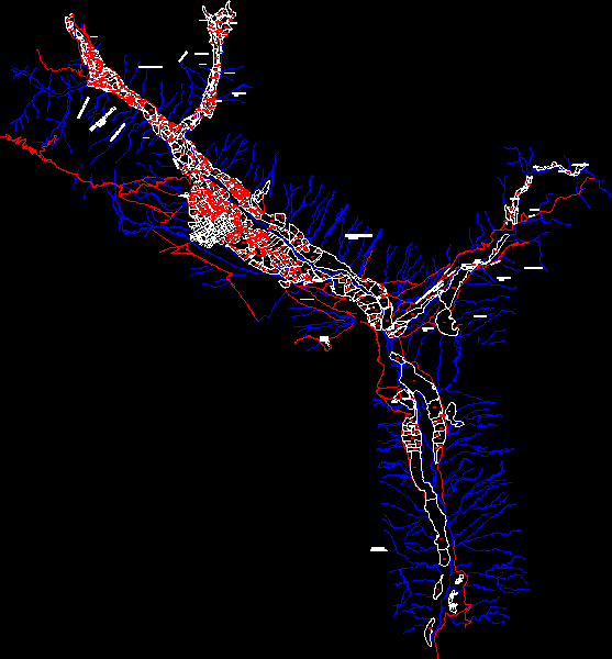
Base Caraveli Utm Cadastral Code DWG Block for AutoCAD

Base Sector of Acari Arequipa with utm coordinates and Cadastral code
Drawing labels, details, and other text information extracted from the CAD file (Translated from Spanish):
moccasin, channel, reservoir, bittersweet, qda. the vizcachas, rio caraveli, broken the iron, channel, rio caraveli, reservoir, district caraveli, gutter creek, ravine, channel, rio caraveli, channel, grasshopper, wiscoro broken, broken trucos, broken huanca, qda. molles, River, rio chuicani, rio caraveli, pond, rio caraveli, waterhole, andeneria preinca, hillside garcia, ford road, the chapel, channel, road to the hill, road of the vasquez, hill of saitiða, Socospampa, hill of, ruins, way chicanery, imirsur, mining, plant, of bulls, square, pampa high anampa, caraveli, bitter hillside, Achanqui sector, Buenos Aires, pp. jj., hill achanqui, hill tingarume, Cerro Salitrero, district caraveli, I closed the tufts, the nose, caraveli district, pampa huanca, chuðuðo sector, hillside iraula, caraveli district, hill ancari, santa rose hill, moccasin, district caraveli, I die the whites, the vizcachas, road mochioca, road chuquibamba, caraveli district, hill of quirquinchos, chaco road, road chuquibamba, caraveli road, old Indian, Hill, z.l., z.l., z.l., z.l., z.l.
Raw text data extracted from CAD file:
| Language | Spanish |
| Drawing Type | Block |
| Category | City Plans |
| Additional Screenshots |
 |
| File Type | dwg |
| Materials | |
| Measurement Units | |
| Footprint Area | |
| Building Features | Car Parking Lot |
| Tags | arequipa, autocad, base, beabsicht, block, borough level, cadastral, code, coordinates, DWG, political map, politische landkarte, proposed urban, road design, sector, stadtplanung, straßenplanung, urban design, urban plan, utm, zoning |


