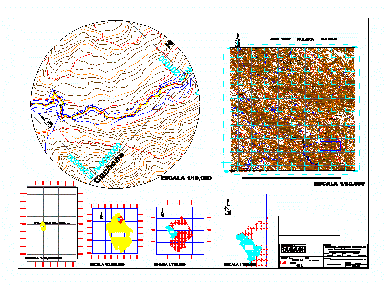
Ciras DWG Block for AutoCAD

Location National Charter Plane – requirement CIRA
Drawing labels, details, and other text information extracted from the CAD file (Translated from Spanish):
indicated, date :, datum :, sheet number, grid, project :, map of :, region :, dist.:, scale :, prov.:, locality :, ancash, ragash, huayllapampa, sihuas, improvement of the infrastructure of the water service for irrigation of the huayllapampa – huanza integrator canal, ragash district, sihuas province – ancash, district municipality, area :, peru, provinciadesihuas, dis. ragash, drawing cad:, progressive, tangent direction, channel details box, channel mileage, channel length, total servitude area, servodrive width, typical channel section, qda. chaupiloma, qda. huirocancha, qda, gachgos, qda., gachgobol, lag. chaquicocha, lag. azulcocha, boy, lag. champococha, lag. morococha, stone bridge, chaquicocha, llama, qda. quinllay, qda. tinco, coyllorcocha, lag. bats cocha, qda. beaches, lag. champacocha, lag. huacacocha, lag. tinyacocha, lag. cushuropata, qda. white river, ullcutay or apple, drums, or pacsha, qda. jet, lag. black, lag. callampife, qda. tucushragra, quinuales, toshia, lag. rimacocha, hucatacra, lag. huashuacocha, tucush, huancha, collota, cachona, paccha, ullcutay, gashilpampa, rura, paredones, tica huasi, tinyacocha, agosho, rimacacha, hda. flame, hda ray, high rosemary, high quingao, quingao, pampa shauana, fields and majada, shinshiayo, alto huangor chico, alto huallgash, tambo gallinazo, champa cocha, rimapampa boy, alto, pallasca, huellapampa ravine, department of ancash
Raw text data extracted from CAD file:
| Language | Spanish |
| Drawing Type | Block |
| Category | Handbooks & Manuals |
| Additional Screenshots |
 |
| File Type | dwg |
| Materials | Other |
| Measurement Units | Metric |
| Footprint Area | |
| Building Features | |
| Tags | autocad, block, charter, DWG, location, national, plane |


